The Derwent dam circular walk is a great way to see a lot of varied scenery and at different times of the year as the colours change and the water recedes at the end of a hot summer.
It has created many lovely memories though the years. From this area in the Peak District springs a whole range of other walks too, so it is a great base to get acquainted with.
This route is pushchair friendly which was a definite bonus when we took our second eldest son, James along for the walk with his young baby in a pushchair, (our grandson, Elijah.)
On special memorial occasions there have been airplane fly overs here at the dams, there have been memorial flights over all of the dams by a spitfire aircraft in past years, and if you had ever the chance to witness this, you’ll never forget it, believe me.

On our winter walk, the seven of us, plus three dogs headed off along the path that runs alongside the access road making it easier with the pushchair but there is a path through the trees and closer to the reservoir if you’re on foot only and wearing sturdy footwear.
Parking is available alongside the road intermittently, some parts are free parking, and some are paid parking spots and there is a main carpark at the visitor centre; from the A57 Snake Pass Road, the Derwent Dam visitor centre is sign posted just after the Ashopton Viaduct which is halfway between Sheffield and Glossop.
Dam Busters History
The Derwent dams are first and foremost known for its part in developing the bouncing bomb used during the second world war, the pilots of 617 Squadron used the Derwent dams to practice low level flights in their Lancaster bombers in preparation for operation Chastise, more widely known as the Dam Buster raids which were carried out on German dams on 16th and 17 May 1943 led by Wing Commander Guy Penrose Gibson, Royal Air Force No 617 Squadron.

The bouncing bomb was developed by Barnes Wallis and was purpose built for the raid on the Möhne, Edersee and Sorpe dams in Germany which the Derwent dams closely resembled.
Ashopton Viaduct
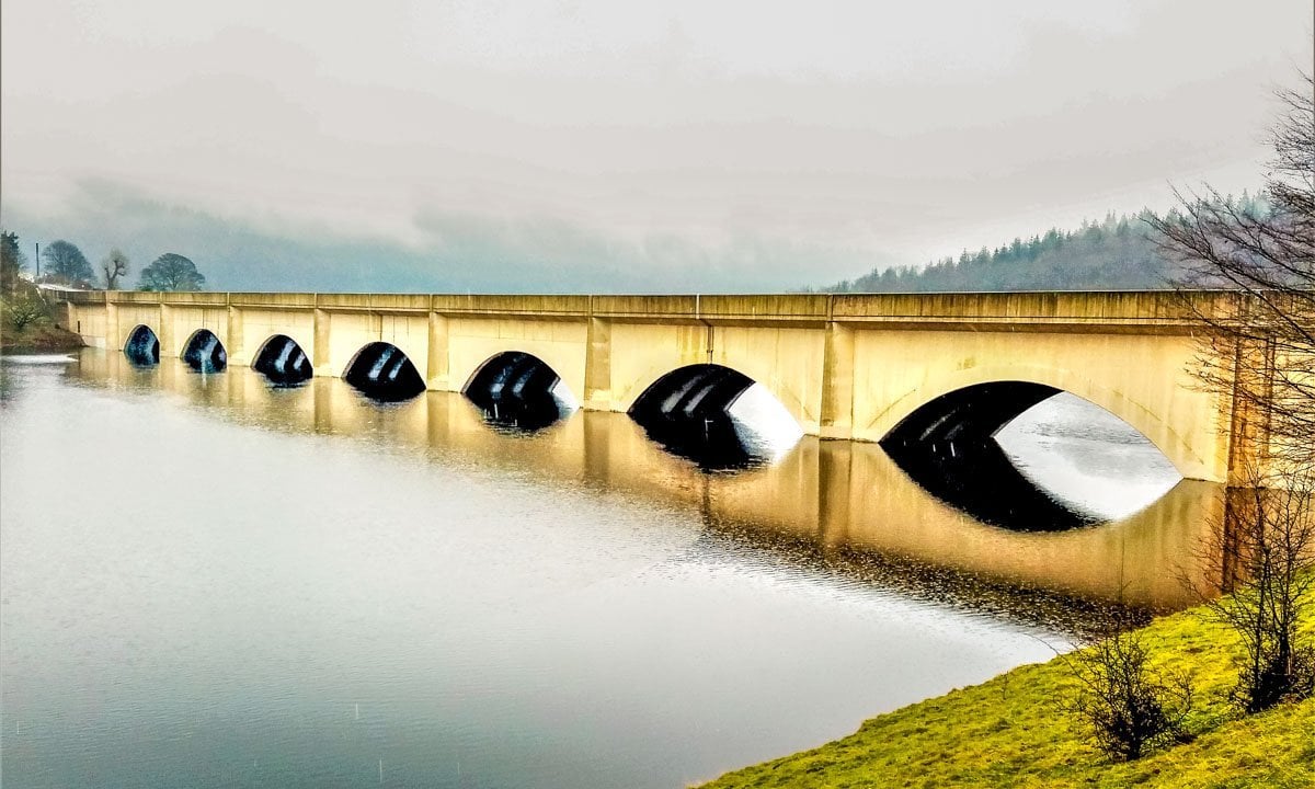
On reaching Ashopton Viaduct on a clear day Win Hill can be admired on the opposite side of Ladybower reservoir, a beautiful sight, but alas on this wet cold morning as we arrived there was a mist across the trees completely masking the other half of the reservoir, I still like this effect because to me it just makes for more atmosphere and mystery.

On crossing the viaduct it’s great to pause half way over and look across the water, it’s so calming to just take in the view and take a moment. We take a left and onwards beside the reservoir, the dogs excited and baby needing a feed.
There are benches all around the route so plenty of chances to stop and take in the view or feed the baby!
Once baby was fed, we strolled on at a leisurely pace until finding a spot for the dogs to take a drink and came across another bench, this time we didn’t need it but would make a beaut of a picnic spot in the summer.

Woodland sheltered us through the next section and plenty of trees for the dogs to water!
Woodland walking is so relaxing and even baby Elijah enjoyed watching the trees go by, he was wide awake the whole time, not wanting to miss a moment of his little adventure, gazing up through his rain cover.

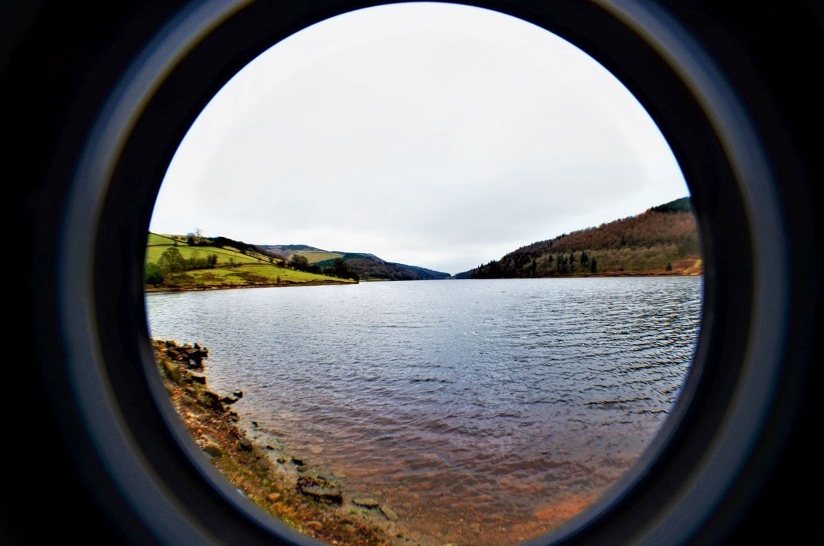
Spring was not too far away as was clear from the flowering of the snowdrops, I always think this is a beautiful sight and a reminder of brighter warmer days ahead. The views over the reservoir are satisfying, the water calm and deep, the trees surrounding the reservoir are reflected as if in a mirror, these are all my favourite sights.
Over topping dam
When the dams are full, after the weather has been particularly stormy or snowy, the overflowing dams are a beautiful sight as the water cascades over the top, it is well worth a visit in winter or in spring after heavy rains have topped up the reservoir sufficiently to be over topping, as it’s called.

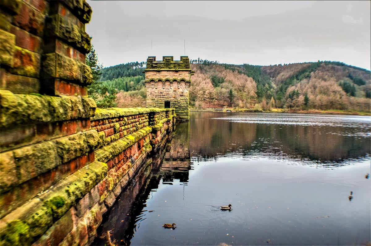
We began to catch a glimpse of the Derwent dam and one of the towers through the trees, on our family visit, it was clear to see it over topping and not at all surprising considering the amount of rain that had dropped.
Although it was not in full flow it was still a fascinating sight, and the sound of it even more spectacular, quite a roar as the water cascades over the top of the dam!
My daughter captured some photos for me using her phone camera whilst I was tied up looking after two of the dogs, big Max and tiny Bandit and hadn’t bought my usual camera with me due to the weather.
To be honest I knew my daughter was more than capable of taking the shots I’d been after, and she did, as always, a keen eye for a photo. It was a tricky day for photography, low light, constant rain and mist but the circuit around to the dam beholds enchanting scenery at every turn.
If it’s a longer walk you’re looking for then a walk to Howden dam, (the twin of Derwent dam) and around Derwent reservoir is another adventure which is well worth exploring.

Fairholmes Visitor Centre location
The visitor centre is a lovely place to start and finish the walk, if you don’t mind paying for parking, plus the facilities available make it easier for families.
There are toilets, a refreshments kiosk and information. Pay and display parking is available here and disabled parking spaces are free.
The refreshments kiosk is open every day from 8am till 6pm. The address for Fairholmes Visitor Centre is:
Fairholmes
Bamford
Hope Valley
S33 0AQ
We stopped at the Fairholmes Visitor Centre for refreshments and to warm up Elijah’s milk bottle.
Once re-caffeinated, baby had been fed, and toilets located for a freshen up, we were off on our merry way with one very sleepy baby and one very cold wet dog, poor little Smokey needing a coat, (Which we investigated asap,) the other two dogs had rain coats.

Walking back along the opposite bank of Ladybower reservoir, the views were stunning, from here looking across the water the hills were still snow covered, and so beautiful even though partially shrouded in mist and reflected in the calm waters.
With only another mile or two, who’s counting, until we reached our parking spot, we made the most of the views and the calmness which baby Elijah found soporific as he dropped off into to a sweet slumber.

Before heading home, we took a quick stop off on our journey to see the plug holes draining at Ladybower dam which is a beautiful place to watch a sunset I might add.

Length of Walk
The circular walk from the Fairhholmes visitor centre to Ashopton viaduct and back around is roughly 6 – 7 miles, (9 -10km) it depends on how much you explore and which path you use, there is one path along the road towards the visitor centre and one alongside the reservoir.
The only difference is walking in possible wet conditions nearer the reservoir or on a tarmac surfaced path.
Memories Of the Dry Derwent Dam Reservoirs

Looking back on the hot dry summer of 2018 and while walking beside the Derwent Dams in the Upper Derwent Valley through the Summer and Autumn, my family and I had watched the water level of the three reservoirs change dramatically from an over topping dam, (flowing over the top of the dam wall,) to barely any water at all, a mere trickle at one point at the Howden reservoir especially, this has only happened on rare occasions.
2018 is one of those rare years where the drowned villages remains have been revealed, the previous years were in 1959, 1976, 1989, 1995, 2003 and rather low in summer 2022.

Further information about the Derwent Dams
The 3 Derwent dams consist of Howden, Derwent and Ladybower reservoirs in the Upper Derwent Valley and are owned and maintained by Severn Trent Water and supply water to Sheffield in South Yorkshire, a large part of Derbyshire, Nottingham and Leicester areas.
The first dam in the series of 3 is Howden dam, which began construction in July 1901. The Howden reservoir is a Y shaped reservoir and is split by a boundary through the middle, an East, West divide, to the East is Sheffield, South Yorkshire and to the West is Derbyshire.
The boundary follows through the middle where the river Derwent originally would have flowed before the construction of the dams began in order to supply water to an ever-growing population.

The ‘drowned’ villages
Through the hot dry summer of 2018, the water levels fell to almost record lows and uncovered parts of the Ashopton and Derwent Villages that were “Drowned” as part of the plan to create the Ladybower reservoir.
As I wrote this, the water had begun rising considerably and eventually covered up those parts of the village that reappeared during the hot summer of 2018 including the Derwent Hall’s foundations and corner stone.

The foundations of most of the other buildings that were visible as the water levels dropped incredibly low have also been reclaimed by the rising reservoir water now too.
Life of a resident during construction
On one particular visit with my family in mid-summer we were lucky to meet with a very lovely couple who were also visiting the Howden reservoir that sunny day, the very nice gent told us how he could remember the construction of the Ladybower dam and how life had changed as the works began, he had lived in Ashopton Village as a young lad and attended the local school there.

When construction started on the Ladybower dam in 1935, his school life and day to day life changed, in fact life in general changed dramatically for all the villagers from Ashopton and Derwent villages.
When the workers came to live on site to construct the Ladybower dam I was told of how his life and that of his family changed forever.
His school life became very disrupted as he was needed at home more often to help out with the laundry duties, his mother and his family went to live at a relative’s farm, they took in family members, who were part of the construction team, ‘Navvies’ as they were known, as well as other workers from the dam construction team, but the extra laundry needed extra pairs of hands, his job was to turn the mangle in the yard; hard work but essential to daily life when there are extra piles of laundry to be done.
School life had to wait when the laundry mangle needed turning, and for sure construction life was not a clean one, I imagine the laundry would have been thoroughly mucky.

It was lovely to hear personal accounts about life in the area through the dam construction and his memories of watching King George Vl officially open the reservoir on September 25th 1945, where he was at the front of the awaiting crowd to watch the king arrive on that momentous day.
Owned by Severn Trent Water
When we’ve been to the snake pass for any reason, we often stop by to take in the views across the Ladybower reservoir, this beautiful Y shaped body of water that we take for granted on our regular trips through the area, a place to walk, a place to relax and take photographs.
It’s not until you look into it’s past and speak to those who remember the demolished villages that now lay beneath the water line, that it brings home the reality of how the area would have been and how lives changed because of the construction of the reservoirs.
The water from these reservoirs is pumped to my home too, due to it being owned and maintained by Severn Trent Water, who serve our area, so it makes me realize how connected I am to the places that I love to visit so often.

Howden reservoir
During the summer while visiting the Upper Derwent Valley my family and I took a walk up to Alport Castles, a 15km walk that began at Ladybower reservoir where we had parked our car, a beautiful location to start from I always think. As always, I took photos of the reservoir along the way and I never tire of those views.

On a family walk in the Autumn of 2018, after parking up near Ladybower reservoir we walked along the track beside the shore line where the water level was clearly dipping low, our destination on that day was just a short walk up to Crook Hill, a small hill with spectacular views over Ladybower reservoir and the Snake Pass a57 and across to Win hill and beyond.

Conclusion
The Upper Derwent Valley is a stunning place to begin any walk from and with amazing views, 2018, and 2022 with such hot summer temperatures, lowered the water levels to such lows only seen on a few occasions, but it is always beautiful, nonetheless.

It’s a beautiful circular route with good access and with toilets and refreshments at the visitor centre too, but if a longer more challenging route is what you’re after there’s plenty of options, take a longer route and incorporate Howden dam, by walking to the Wheel Stones on Derwent Edge and following the footpath down to Howden reservoir once you reach the trig point at back tor, or there’re is a very scenic walk up high to spectacular views at Alport Castles.

I recommend purchasing a map for the area. You should look for The Peak District Dark Peak Area Map, Peak District National Park, Ordnance Survey, OS Explorer Map OL 01.
If planning a visit to the area by car, I would suggest parking at either Heatherdene carpark on the a6013 Bamford Road where you will also find toilet facilities, or another good place to park is at Fairholmes at the Derwent dams’ visitor centre or of course there’s limited, free roadside parking if you arrive early enough and park in designated parking spots.


Looks absolutely stunning. Can u tell me how far this circular walk is and where about you started from please. Possible postcode maybe x
Hello Trudy,
Thank you, it’s a beautiful area indeed.
For parking, there’s often parking space available for free in dedicated spaces beside Ladybower reservoir. Best parking but paid for is at Fairholmes visitor centre post code Hope Valley S33 0AQ
The circular walk from Fairholmes visitor centre around past the dam and over Ashopton viaduct, and along the other side to a full circle is roughly 6 miles (9km.) or taken the other way around.
I hope you manage to visit and enjoy the area.
kind regards,
Janine
Beautiful and interesting! Tell me, how did the Derwent Damn drown??
Hello Jane,
It really is a lovely area to explore. Thank you very much, I’m glad you’ve found it interesting.
By drowning, do you mean how the dam overflowsin the photo? This will happen after a good winters rain and snow has filled the Derwent and Howden reservoirs, enough to allow it to, over top, to flow over the top of the dam.
This year has been a hot year, and the reservoirs are all very low indeed and so are quite low for the time of year. I hope I’ve answered your question. Thanks again, Janine
Hi Charlie,
I’m sure you would enjoy the area, it’s well worth stopping to explore. Thanks for the lovely coment on the photos too.
All the best,
Janine
We often drive along Snake Pass when visiting family, so will have to stop and do this walk! Looks lovely. Great photos!