Where does trekking end and mountaineering begin? I don’t know if there is definitive answer to this question, but I would suggest that it can be found somewhere on the way to the top of Mera Peak in Nepal.
Roped together and kitted up on the 6476 metre (21,247 feet) summit of Mera Peak with views across to Everest and the rest of the world’s biggest mountains feels like mountaineering.
I have always wanted to go to Nepal and experience the towering mountains of the Himalaya, and to spend some time with the Sherpa people who allow us to share their world with them.
This year I went on an expedition to climb Mera Peak with a load of strangers and a fabulous Sherpa team who made it all possible.
So how did I end up on top of Mera Peak? I am not a mountaineer, but I have spent many mountain days on peaks across the UK and Europe, and I had prior experience of high-altitude trekking on Kilimanjaro.
I cannot give you expert advice on climbing Himalayan peaks, but I will share my experience on what I did to get to top of Mera Peak.
Preparation
Most people will do Mera Peak as part of an organised expedition with a specialist travel company or independently using local guides.
For me finding the right company to go with was the most important thing to get right, and I spent a lot of time researching the different operators offering trips.
If something goes wrong in a high-altitude environment, then you want to be with a team who know what to do. I decided to go with British company Jagged Globe who have a reputation for running great expeditions and I could not recommend them highly enough.
There are inherent dangers involved in climbing remote 6000m plus peaks so I wanted to be with people who could minimise those risks.
Their trip was slightly longer than others but designed to include an acclimatisation profile that would give the team the best chance of success and nine out of ten of the team successfully climbed on summit night.
Jagged Globe ran a pre-trip weekend in the Peak District a few months before the trip which was invaluable preparation. As well as having the chance to meet fellow team members, they gave us useful insights into what to expect on the trip and all the things that could go terribly wrong.
Developing high altitude cerebral oedema (HACE) is potentially very serious, so it was good to know what symptoms to look out for and to know that our team would have medical kit to help deal with it should the worse happen.
As it happened, at high camp on the trip our team were approached to help someone from another team who was suffering from HACE and was in a pretty bad way.
A combination of our medical supplies, the intervention of the mountain leaders in our team, and the help of a medical professional who was a client within our group probably saved this person’s life.
Kit
I am not going to run through a full kit list here but packing for this sort of trip is tricky. You need clothes for warm weather and extreme cold and everything in between.
However, you are restricted by the technical gear you will need on the mountain plus weight restrictions as all your gear needs carrying up and off the mountain.
Trying to be minimalistic whilst taking everything that you absolutely need is a fine balancing act and some sacrifices need to be made.
Without oversharing too much, multi-day use friendly merino wool becomes your best friend on a high-altitude expedition. I took more pairs of ear plugs than boxer shorts on the trip and some of my clothing could have walked itself off the mountain by the end of the third week.
You can wash clothes out on the trail and the rest days will allow you restore some semblance of hygiene standards.
High altitude kit is both the most important and expensive investment if you do not already own it, and gloves and footwear are the two areas that you do not want to cut any corners on.
You will regret saving £100 on the wrong gloves if you have to turn back at 4am on summit night because your fingers have gone numb.
My love affair with outdoor shops meant I already had most of the gear needed, but the extra money I spent on my super warm Black Diamond Alti mitts and the Mountain Equipment K7 down jacket was money well spent on the summit.
Technical high altitude double boots are needed for the days on the glacier, and my La Sportiva G2 SM boots kept my feet toastie although walking in stiff boots does take some getting used to.
Of course, we also needed some hardware such as crampons, ice axe, a harness, and we also took a fixed line kit for ascending the fixed ropes and a descender for abseiling although we only used the latter during some training.
Other essentials would include wash kits, blister packs, sunscreen, and medication for the inevitable headaches. And anyone who has slept in tents or dorms will know to pack earplugs to drown out snorers.
Training
Being as fit as you can will improve your chances of succeeding so I did 3-4 months of targeted training for this trip. I had a good aerobic fitness base but I took advice from mountain specific training resources such as uphillathlete which also do some really interesting podcasts, and trainingpeaks to help build aerobic endurance.
There are plenty of other resources out there and the simple goal is to improve your fitness and to train your body for multi-day endurance activities. Although you cannot replicate the challenges of operating at altitude physically preparing as well as you can gives you the best opportunity of succeeding.
The Trek
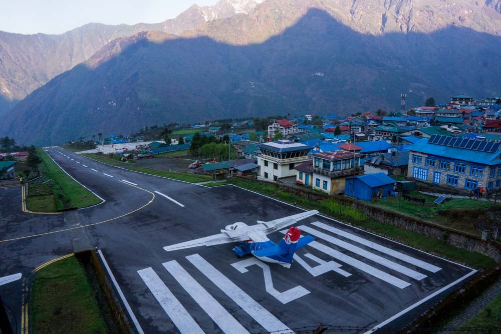
Landing at Lukla airport, and its 500-metre-long sloping runway was another life goal ticked off.
Lukla is the gateway to the Himalayas and the starting point for so many people heading to Everest base camp and other mountains in the region.
We would spend the next 12 days trekking to Khare and preparing for the summit attempt, followed by 2 days at high camp and the summit, and then a 3-day trek back to Lukla.
We would hike 125km in total with just short of 10,000 metres of cumulative ascent – Everest is 8840m by comparison.
Before setting off we had an unexpected stopover in Lukla whilst we waited for some of our bags to arrive. It was a first insight into the wheeling and dealing that goes on between the Sherpa teams and airline tour operators.
Both the domestic departures area at Kathmandu and Lukla are chaotic spaces where there are as many people involved in the frantic haggling process to get people on a plane, as there were people getting on the plane.
Lukla’s situation means conditions are not always favourable and flights get delayed for hours and sometimes days – we waited for 5 hours for each of our flights.
Even if you manage to get onto a plane, there is no guarantee that your bags will, but they will catch up with you at some point. It is just the way things work up there.
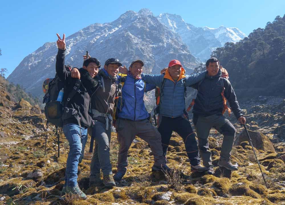
The start of the trip meant meeting our Sherpa team for the first time. We were a team of ten plus one leader from Jagged Globe, all from the UK and Ireland.
The Sherpa team was led by our Sirdar, who had overall responsibility for leading the expedition and managing the Sherpa team.
There were four climbing Sherpas who would set the metronomic pace on the trek up to base camp, and then lead us in small groups on the mountain.
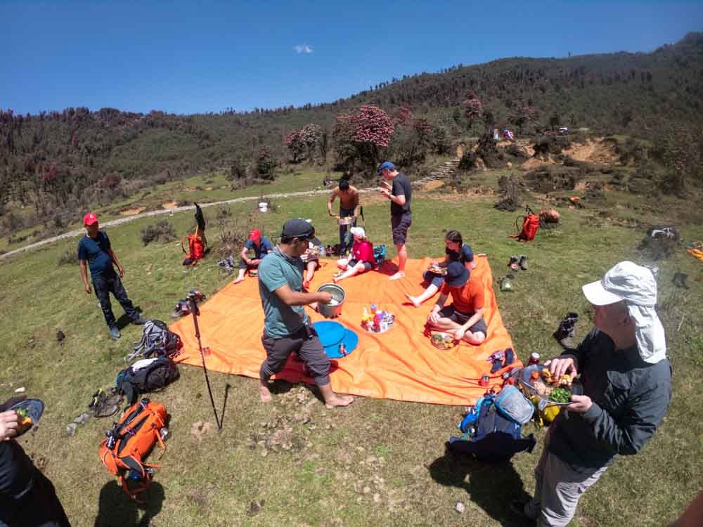
A large cook team that would produce fantastic carb heavy, mainly vegetarian meals cooked to the same high standard whether in tea houses, camp sites, or in makeshift setups in forest openings.
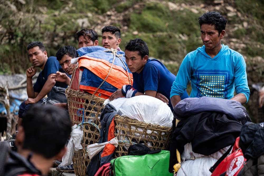
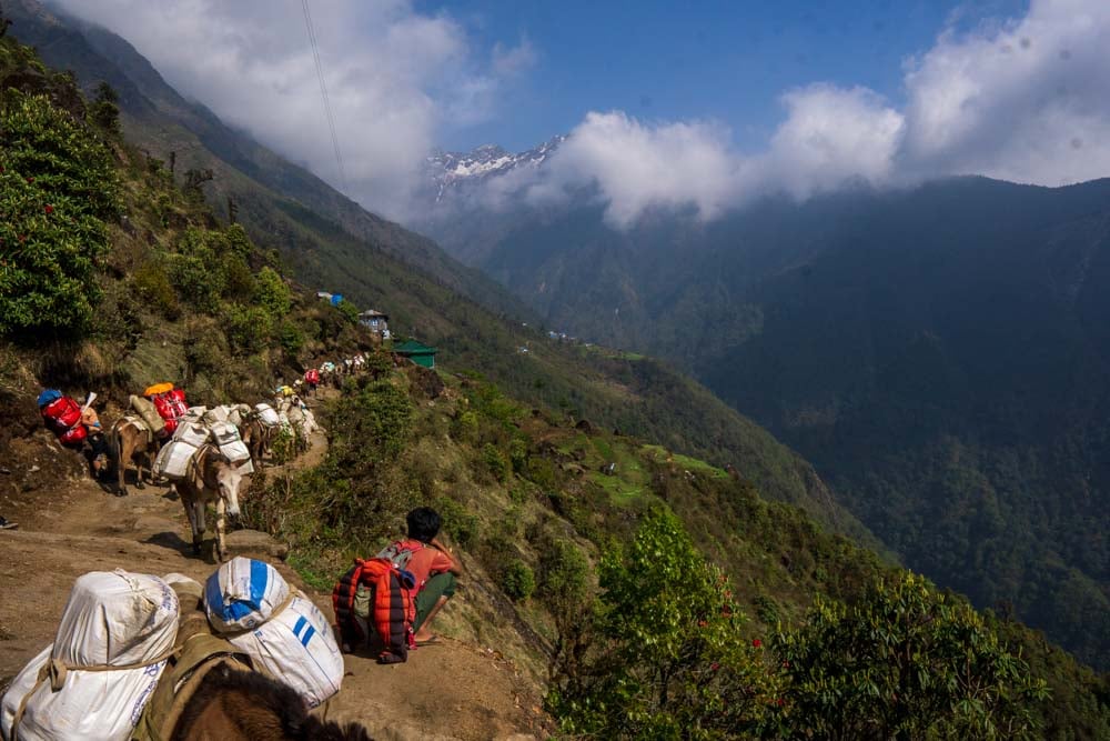
Finally, we had the phenomenal team of porters. These were mainly young boys, of 15-16 years old who would each carry around 40kg of our bags, tents, and other kit up and down the same mountain trails that would break us with only our day packs on our backs. They are made of different stuff.
Lukla to Khola Kharka – 5 days
The trek can be split into four sections. The first 5 days began with a circuitous route from Lukla though to Khola Kharka designed to gently acclimatise us as well as building expedition rhythm.
The weather was warm and muggy as we ambled through steamy mountain forests and farmland in shorts, t-shirts, and sun hats.
Each day would start with a 6-7-8. A 6 o’clock alarm call with black tea and hot washing water brought to the tents. 7 was breakfast in the tea house, and 8am was the set off time.
We would usually walk for 3-4 hours, stop for lunch at another tea house or forest clearing, and then do another 2-3 hours walking in the afternoon before reaching our next camping stop.
Each evening would be dinner, a debrief on the day just gone and the plan for tomorrow, and a health check on the fitness of the team.
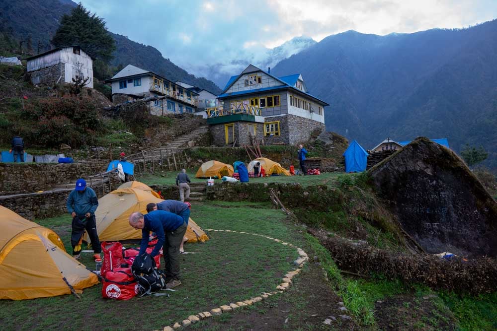
We camped most days outside a teahouse and ate inside them in the evening, and later in the trip we also slept in them.
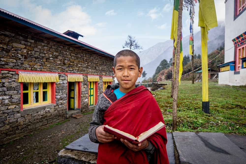
The highlight of the first part off the trek was a visit to the remote Takshindu Monastery where the young monks were as curious to see the western trekkers as we were to see them.
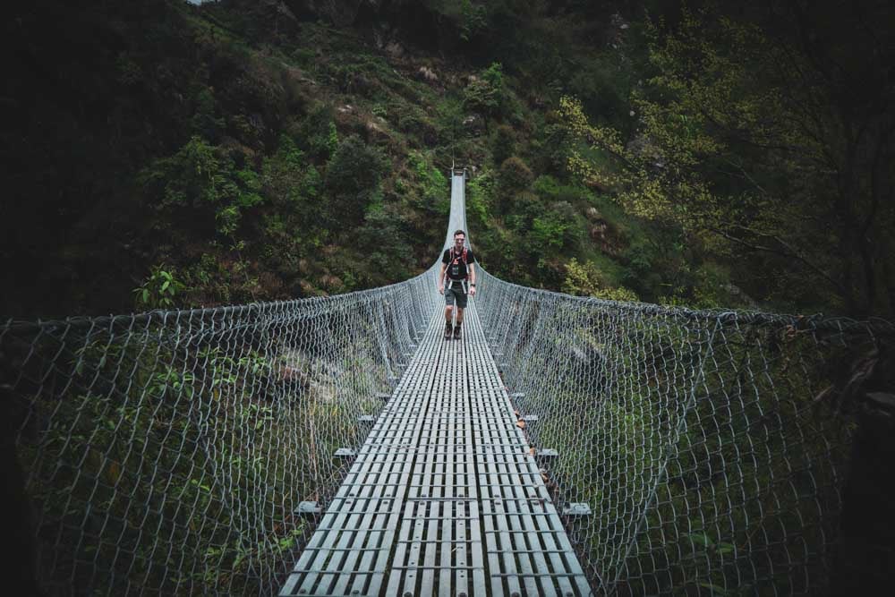
On the same day we descended a steep path through rhododendron forests to cross the Hinku valley for the first time, crossing one of the spectacular rope bridges that this part of the world is famous for.
The hardest day came as we ascended 900 metres to push through 4000 meters for the first time, before arriving at Khola Kharka, a cold and unwelcoming place that was in constant shadow from the mountains that surrounded it.
Altitude sickness was starting to affect us all, mainly with headaches that could be dealt with through painkillers, but some of team were also struggling with a bit of exhaustion.
Lying in the tent that night, unable to sleep, feeling rough, and with condensation freezing on my face as the temperature dropped below zero, I was beginning to question the wisdom of spending money and precious holiday allowance on this godforsaken place.
However, sunrise, breakfast, and some stunning high mountain views soon helped me get my head back in the game.
These first days gave the group the chance to get to know each other. Being thrown together with a bunch of strangers is one of the challenges of an expedition such as this, but also one of the pleasures.
Walking and talking to find out each other’s backstories is part of the fun. Naturally, we all shared common ground as you do not sign up for a 3-week expedition to the Himalayas without a love for the great outdoors.
However, it was interesting listening to the varied experiences of the team and the trips and mountains they had done before.
Across the next few weeks, we would be living at close quarters, sharing experiences, toilet roll, and creating bonds that would help each other through testing and sometimes emotional times.
A useful tip is that you need to pace your anecdotes. If you rush through your best stories in the first few days then material is going to be thin on the ground for the latter days of the trek, not that conversation flows so freely above 5000 meters anyway.
Khola Kharka to Khare
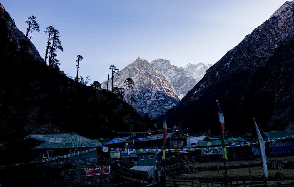
Dropping down to Kothe and oxygen rich air, as well as an overnight stay inside a teahouse instead of a tent raised everyone’s spirits.
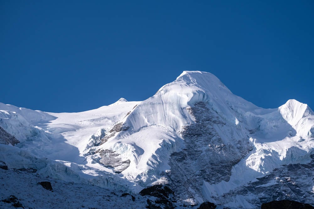
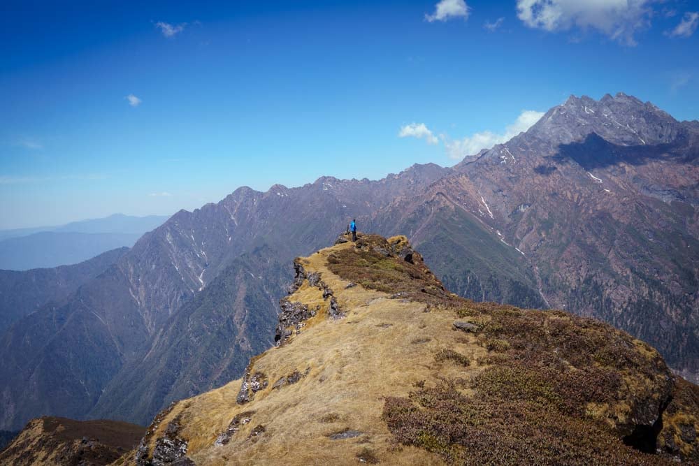
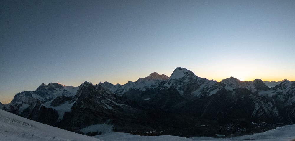
The next few days would see us trek through the vast glacial Hinku valley and into quite different high mountain environment. The early morning view from Kothe gave us our first view of Mera Peak, a mere 3000 metres above us.
The scale of the mountains here is staggering. You try and rationalise the size by comparing them to the mountains that you are familiar with in the UK or Europe, but it is impossible. This was another level of mountaineering that we were entering in to.
Around every corner a new view appeared. I stared up at Kyashar or Peak 43 as it is also known, wondering if its sheer sided walls had ever been scaled (they have), or looking at the immense western walls of Mera Peak as the occasional mini avalanche rumbled down.
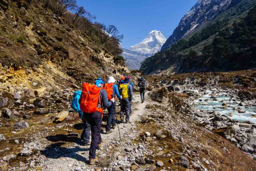
This part of the Hinku Valley is remote and the few people we passed each day were heading to or back from Mera Peak. Most of those returning looked upon us with sympathetic eyes, wishing us well for what was to come.
At the small hamlet of Tangnag we had our first ‘rest day’ which involved pushing our altitude limit on a short morning walk and undertaking rope skills training in the afternoon.
We also had internet access which gave us contact with the outside world for the first time in a few days for those that wanted to see what was happening outside of the Hinku Valley.
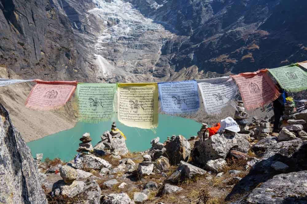
The route to Khare involved a slight diversion to see the beautiful Sabai Tsho glacial lake, and its deep blue water before we arrived at Khare which would be our base for the summit attempt.
Khare to Mera Peak Summit
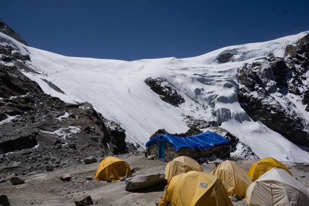
The village of Khare is the launch pad for most Mera Peak summit attempts with teams making one or two stopovers using high and lower base camps on the Mera La glacier.
As we walked into Khare the snow started falling and a storm was on its way which would later mean using one of the contingency days built into our schedule.
Thankfully, we stayed in one of the teahouses as opposed to camping which allowed for a little more comfort and rest ahead of the summit attempt, although sleeping at 5000 metres is in no way restful.
A combination of increased daily hydration requirements, altitude, and the freezing weather mean that your bladder is giving you regular two hourly alarms calls.
Wish your compadres good night and then tell them that you look forward to meeting up in the toilet queue at midnight, 2am, 4am and so on.
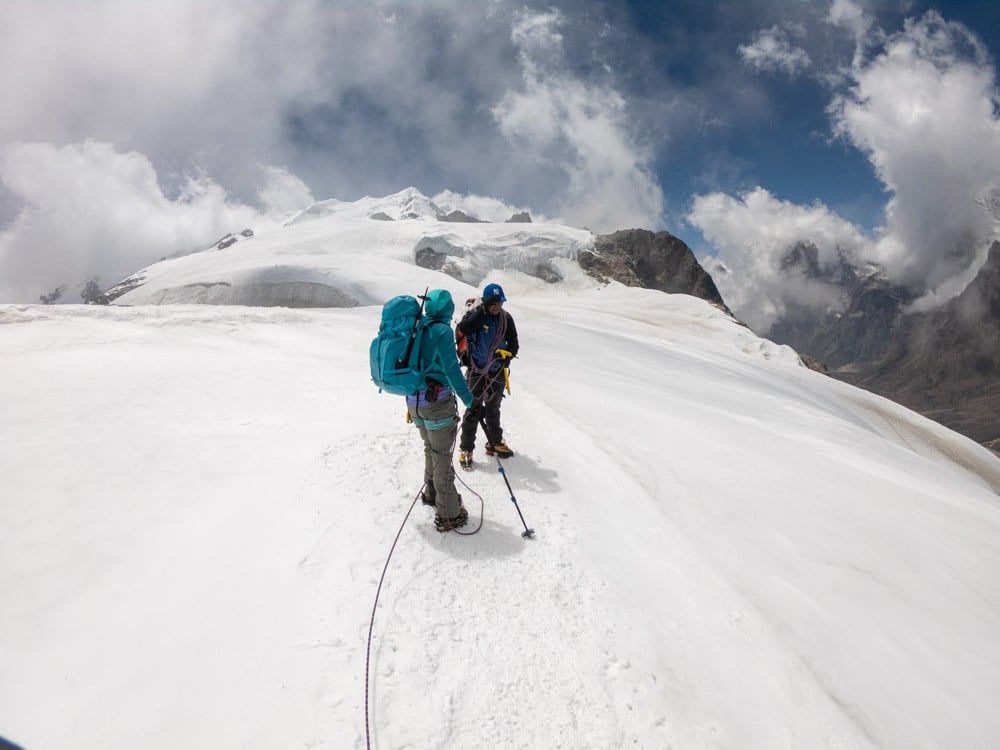
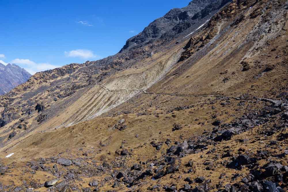
An acclimatisation day on the Mera Glacier gave us the first opportunity to do some proper mountaineering. The route up the glacier is very steep with fixed ropes needed in some places to haul yourself up the icy steeper sections.
This required full kit, double boots. crampons, ice axe, harness, and being roped together in small teams of 3-4. The steep start was a calf burner and gave us little time to get used to walking in crampons or being roped together.
Everything above 5000 metres is tough, and each step requires effort that has you gasping for breath. In the cloud the weather is freezing, but as soon as the sun pops out the glacier is roasting so heat regulation is a nightmare.
Despite the arduous work this was exciting and although thick cloud meant the views were not great, it felt like this was what we had come for.
After a rest day in Khare to wait out the storm we set off on our summit attempt under clear blue skies, hoping that the vulture circling above us was not a portent of things to come.
Again, this was hard going, but we were feeling the benefit of the acclimatisation day as we pressed on to high camp at 5800m.
The improved weather conditions meant that we had clear views in all directions. To the south was the never-ending incline up to high base camp, behind us to the north were the biggest mountains in the world. It was amazing.
After much effort and crossing a few narrow but deep crevasses we reached the rocky outcrop that was high base camp.
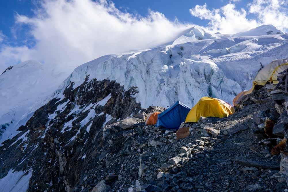
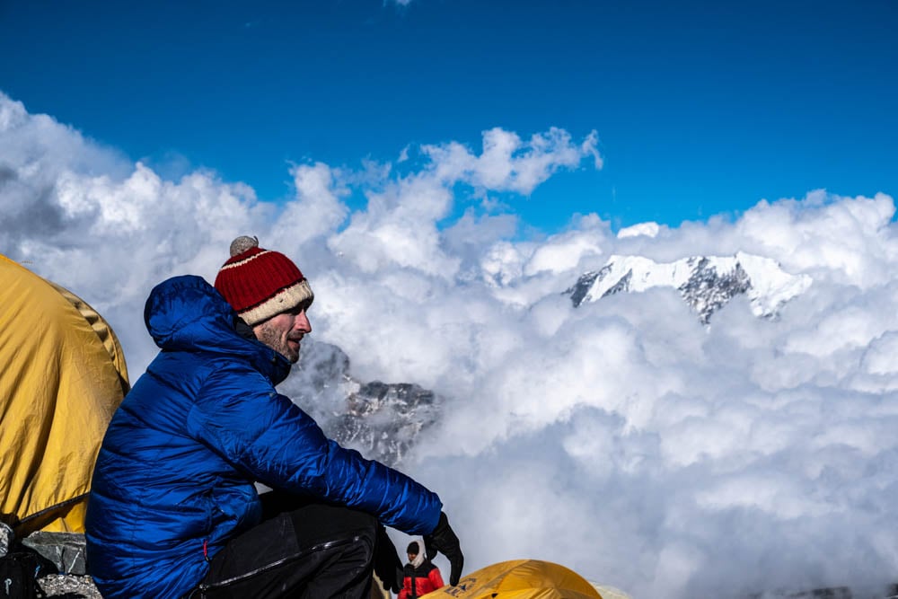
Positioned right on the edge of the glacier, high camp was a small rocky area, which itself plummeted away to a rocky and snowy valley below.
Tents were placed in the few flattish areas, but this was essentially a field of rocks, and we knew a night of comfortable sleep was unlikely. It felt like the edge of the world.
In the late afternoon, a couple of us wrapped up and walked on to the glacier to take in the ethereal views of clouds rushing across Everest and the stunning mountain ranges to the north.
I was too tired and cold to take it all in, but it was a beautiful scene. Back at camp there was time to take on more fluid, and an evening meal of dal bhat in our tents before we prepared our gear and tried to get some sleep on the sloping bed of rocky misery.
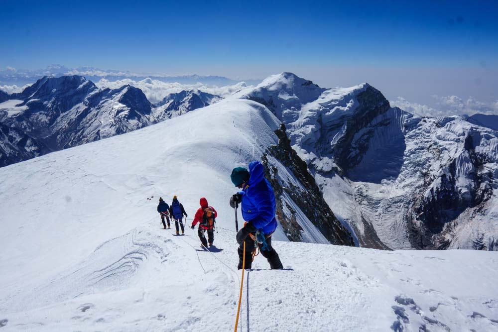
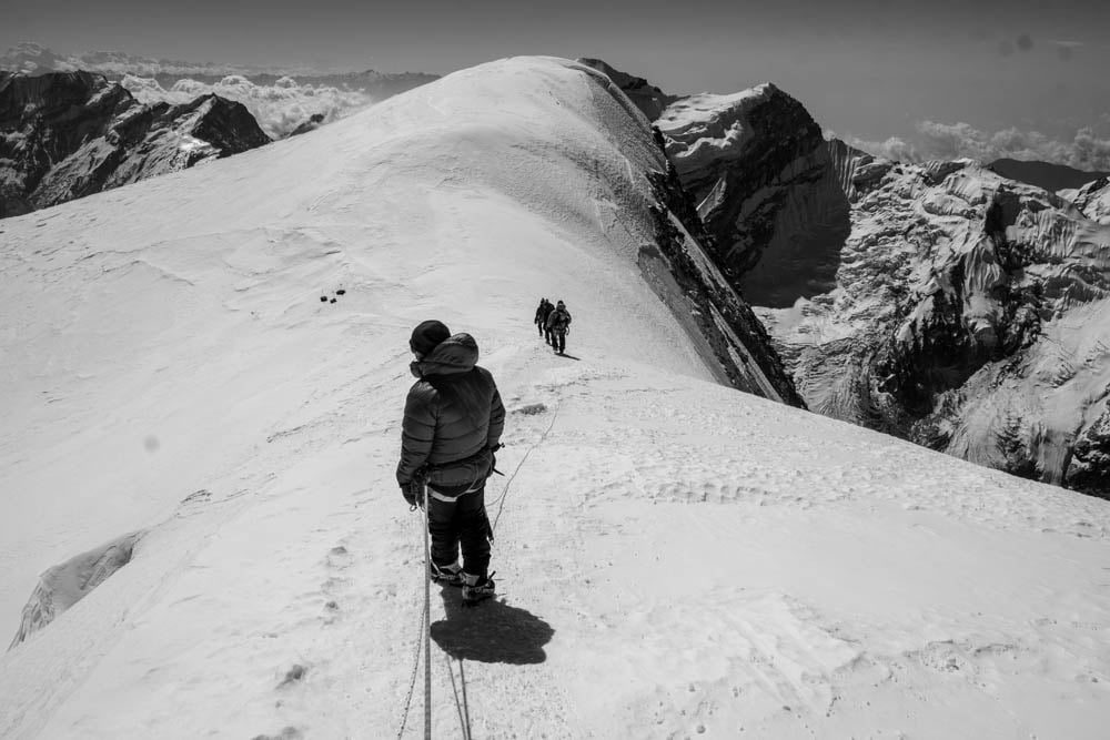
A 2am alarm call came with some tea and porridge and then we were up and out and heading for the summit. We were roped together in groups of four including a climbing Sherpa leading each team. It was freezing and on the glacier the wind ripped in picking up spindrift that peppered our faces as we hit the exposed parts of the mountain.
Above us the sky was clear and full of the brightest stars. I could have spent hours gazing at the beauty of unexplored solar systems if I were not spending so much time hunched over my walking poles, staring at my feet, and desperately trying to suck in oxygen that was not there.
Any effort above 5000 metres is hard going and walking uphill above 6000 metres for several hours is just unpleasant. You are just battling to put a series of steps in front of each other in between short rest stops in the hope that the next time you put your head up the summit will be near.
Hazards came in the form of crevasses that needed a long stride or a jump to traverse. Being roped together, this required some co-ordination, so you did not pull anyone over, plus the combination of crampons and heavy legs meant that extra care was needed as we stepped over dark black crevasses that wanted to swallow you up.
One of our group tripped and fell into one of the crevasses, but the rope system worked and the combined weight of the rest of us caught his fall so that he only went into his waist. He scrambled out unscathed but with a slightly increased heart rate.
Sunrise raised morale and watching the morning colours over those mountains is a sight that will forever be imprinted on my mind.
However, the uphill was a continual struggle and there was no peak on the immediate horizon. I pulled an overpriced snickers bars out of my pocket for a much-needed energy boost only to find it was frozen solid. Damn it!
Thankfully, the double boots and super-warm socks were keeping my toes from freezing if not my snacks.
By this point I would have accepted our sherpa leader taking me onto the nearest lump of ice and telling me I was on the peak, but eventually the summit appeared.
The summit of Mera Peak is a steep 20 metre section with fixed ropes and a flat peak on top with sharp drops on three sides. We left our packs and walking poles at the bottom and with a final push headed up to the top with just ice axes and cameras, and at 8.50am on 24th April I was on the summit of Mera Peak.
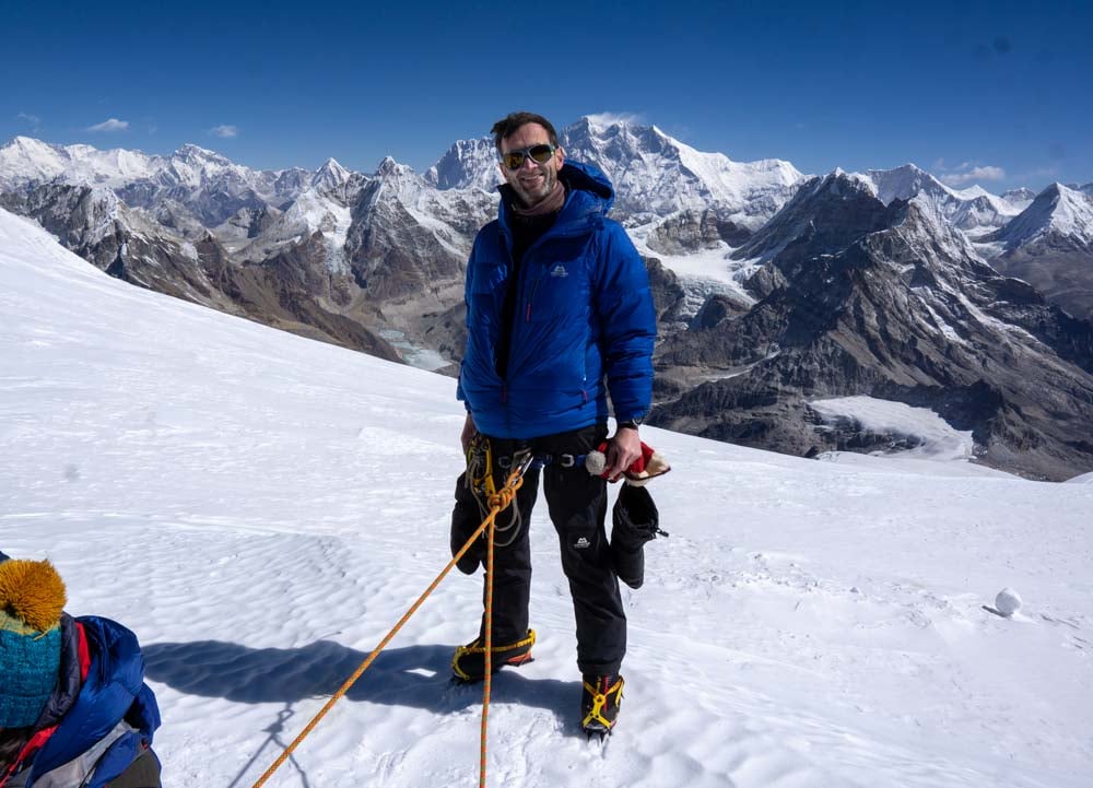
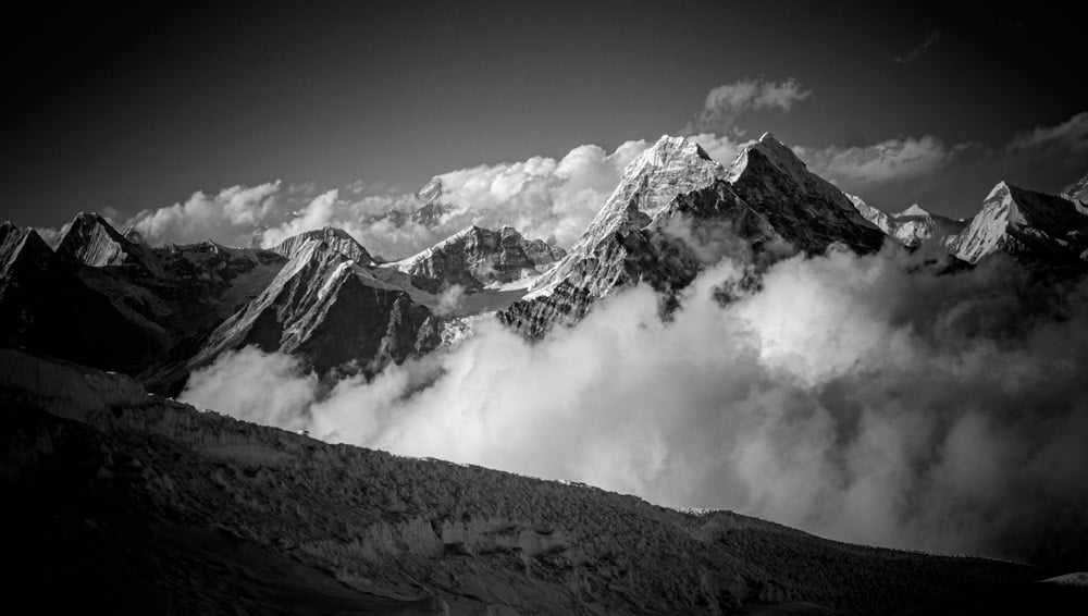
The summit provides the most beautiful panorama I have seen; Everest, Lhotse, Nuptse, and Makalu lead the cast of mountain stars in front of you.
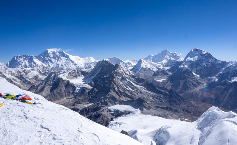
Kanchenjunga and Cho Oyu are prominent in the distance. Behind you Mera Peaks drops down 3000 metres back towards Kothe and beyond that is the rest of Nepal.
Earlier at Khare, the professional mountaineer David Göttler told us Mera Peak had the best views in the Himalayas. He would know and I had to agree. It is the best place I have ever been.
The return to Lukla via the Zawtra La Pass
From the peak we headed back to High Camp, rested for half an hour, ate whatever we could digest, and then packed up our gear and walked back to Khare where we crashed after an exceptionally long day.
The next day was all downhill as we breezed through Tangnag, wishing the poor souls walking the other way good luck, before spending another night in Kothe.
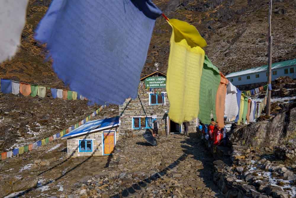
The sting in the tail came in the journey over the Zawtra La Pass which involved 1600 metres of ascent, which seemed like a cruel Nepalese joke, and was compounded by a hail and lightning storm that hit us shortly before the sanctuary of the Lama Lodge tea house at Thule Kharka.
After crossing the pass, the next morning all that remained was the 1800 metre descent back into Lukla for a celebration with our sherpa team, before saying our goodbyes and heading back to civilisation and a much-needed shower in Kathmandu.
Route, distance, and ascent details
- Day 1 – Lukla to Paiya. 10.7km. 643m ascent. 642m descent
- Day 2 – Paiya to Panggom. 12.35km. 965m ascent. 805m descent
- Day 3 – Panggom to Nashing Dingma. 9.27km. 831m ascent. 1,252m descent
- Day 4 – Nashing Dingma to Chalem Kharka. 6.50km. 900m ascent. 98m descent
- Day 5 – Chalem Kharka to Khola Kharka. 5.62km. 886m ascent. 225m descent
- Day 6 – Khola Kharka to Kothe. 8.68km. 349m ascent. 944m descent
- Day 7 – Kothe to Tangnag. 9.58km. 563m ascent. 7m descent
- Day 8 – Tangnag acclimatisation walk. 4.44km. 479m ascent. 479m descent
- Day 9 – Tangnag to Khare. 5.89km. 685m ascent. 50m descent
- Day 10 – Rest day. Short acclimatisation walk
- Day 11 – Khare to Mera La Glacier acclimatisation. 5.92km. 556m ascent. 556m descent
- Day 12 – Khare to Mera Peak High Camp. 4.36km. 723m ascent. 0m descent
- Day 13 part 1 – High Camp to Mera Peak Summit. 4.88km. 674m ascent. 674m descent
- Day 13 part 2 – High Camp to Khare. 4.52km 36m ascent. 860m descent
- Day 14 – Khare to Kothe. 14.81km. 21m ascent. 1328m descent
- Day 15 – Kothe to Thule Kharka. 7.40km. 1103m ascent. 360m descent
- Day 16 – Thule Kharka to Lukla. 10.29km. 503m ascent. 1780m descent
You may also like to read The Annapurna Circuit – An epic Trek and A Hike To Tiger’s Nest Teahouse – Bhutan

Great blog Paul,
I am heading to Mera peak next year 2023 Oct with a crew of friends
Can’t wait , valuable writing ,
Loved it
Thanks Scott – good luck for your trip. It’s a beautiful place and an amazing experience.
Nice write up Paul, it brings back so many wanted and sometimes unwanted memories from the expedition. Cracking photos too!
Cheers James – I love it more with every day that passes without us being on that mountain!