Just 8 miles north west of York, between the villages of Long Marston and Tockwith, on 2nd July 1644, The battle of Marston Moor, one of the biggest battles ever on British soil, took place.
A battle that to say it had such a huge effect on UK history, it never seems to get the historic fanfare that you would think it should, compared with other battles in the civil war or through the centuries.
Over 40,000 men took part in the battle and well over 4000 men lost their life in a bloody battle lasting only 2 hours.
It was the day Oliver Cromwell came to be recognised and it was also the day that King Charles I and the Royalists lost the North of England.
Where Was The Battle of Marston Moor?
There are no roads signs in the local area that directs people to the spot, so I headed there with prior knowledge of the location.
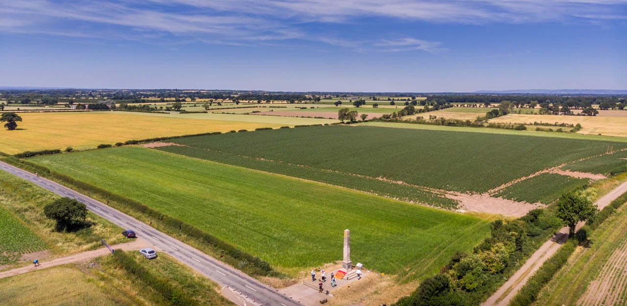
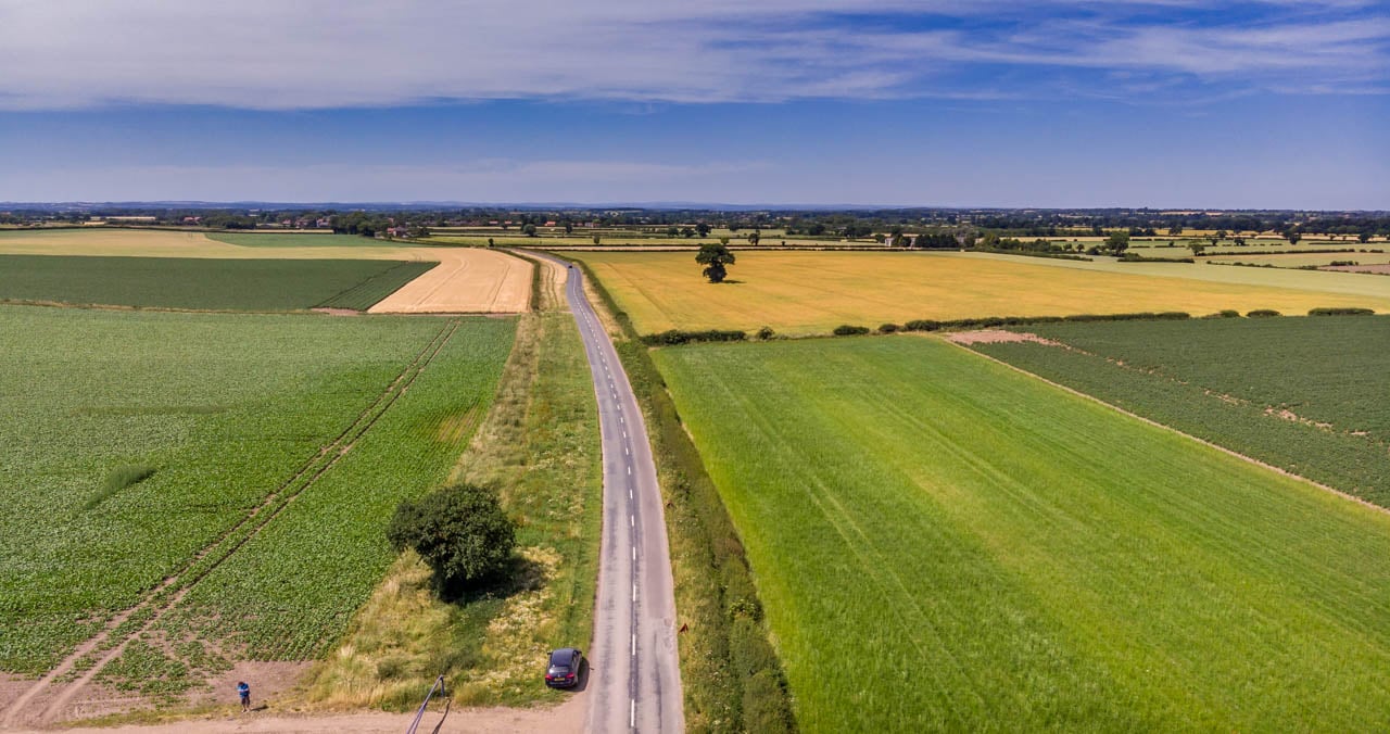
If you are looking an a map it is on the road, Tockwith Road, between the villages of Long Marston and Tockwith, 8 miles north of York.
The postcode to help guide you to the monument is YO26 7PJ.
Apart from the monument the whole of what was the battlefield is agricultural fields and tree lined hedges.
The Monument and Ground References
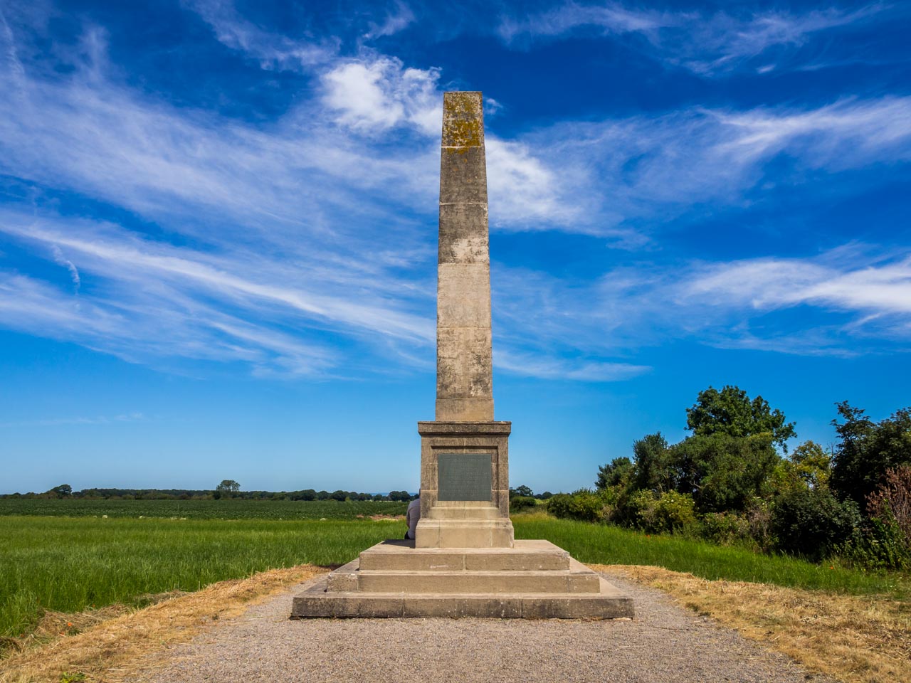
On the roadside there is a monument to the battle, situated right in the middle of where the battle lines were drawn back in that day in 1644.
There is a well laid out and informative information board on site beside the monument, that gives a brief overview of the battleground but also points of reference in the surrounding area.
To the South, the right hand side of the road shown in the photo above, the Royalist Army under Prince Rupert of the Rhine were located.
To the left on higher ground, the Allies of Parliamentary and Scots troops made ready, under command of the likes of Oliver Cromwell and Lord Fairfax.
In total there were approximately 11,000 Royalist infantry with 7000 cavalry, and 20,000 allied infantry and 7,000 cavalry. That is huge and sobering even more if you stand in the location looking around.
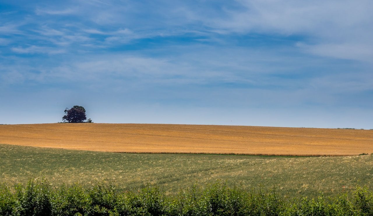
Up on the ridge to the north there is a clump of trees, known as Cromwell’s Plump. Said to be where he and others made plans. Geographically it may not entirely correct as Cromwell was known to have led the left flank nearer Tockwith.
This clump of trees though could well have been though, were the allied leaders met.
The Battle
To give a little pre battle background, throughout the Summer of that year, 1644, the Royalist held City of York had been under siege from Parliamentary forces.
The River Ouse had been a good outer protection for the City but the Parliamentary troops had built a bridge of boats in the village of Poppleton.
Prince Rupert, for the Royalists, was over in Lancashire, doing well for the cause. Setting off from Shrewsbury, taking Stockport, routing Bolton and resting in Bury.
He then received a letter from the King, which he took as a command to free York and do battle with Parliamentary Forces there, so he headed over the Pennines with his army and reinforcements.
We must remember that Prince Rupert was one of the most feared soldiers and leaders in his day. He did successfully get into York to help deter the threat, but, he must have been very arrogant and confident too, as he wanted to go into immediate battle rather than consolidate or rest.
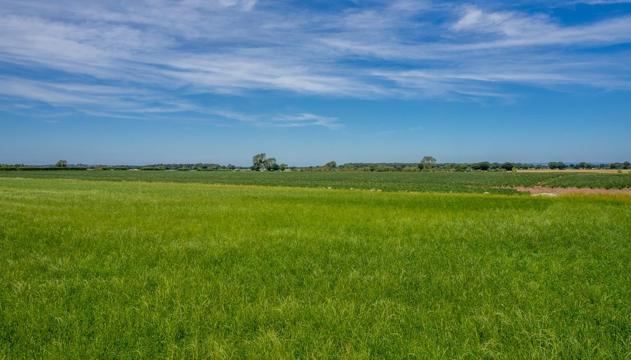
The opposing armies all formed up facing each other in the these fields of Marston Moor, which were back then covered in gorse.
A thunder storm struck at 7.30 that evening, 2 July, 1644.
The Parliamentarians and Scots attacked forwards. To the left flank, Cromwell smashed the Royalist right wing. To the right the Royalist smashed back through the Scots infantry.
However, Cromwell and his cavalry came inside to smash through the centre.
In the midst of this battle, Cromwell had been injured in the neck, but led on regardless! Prince Rupert thus came up with a name for him, Ironside, that nickname eventually became the name for Cromwell’s troops.
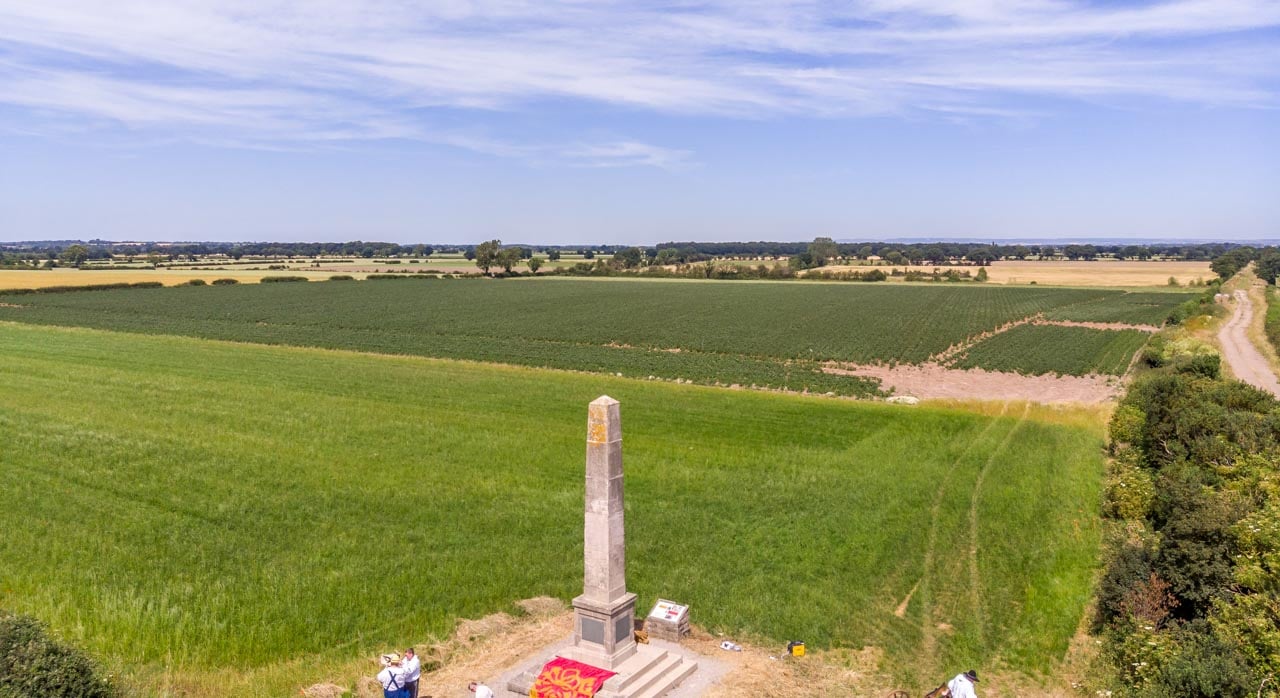
The Royalists were annihilated, well over 4000 dead. Under these fields there are mass graves. The past kept hidden beneath the meadows and farmland.
The farmers here still find belt buckles, spurs and musket balls etc, a reminder of a battle and fallen men.
The North was lost for the Royalists, Prince Rupert headed South to concentrate there with the King.
York fell 2 weeks later to the Parliamentarians and less than 2 years later King Charles surrendered at Newark.
The Local Area
The 2 villages of long Marston and Tockwith are a lovely sight in themselves and worth exploring if you are in the area.
In his diaries, Cromwell wrote,
“If heaven should be half as blessed as the fields of Tockwith, all those who should pass St. Peter’s Gate shall be met with joys unequalled”.
Oliver Cromwell
Conclusion
History was changed that day. This brutal battle, nearly 370 years ago, was pivotal in the Civil War.
Today the monument stands as a reminder of a day that lots of blood was spilt and reputations were enhanced or harmed.
Another interesting British Battlefield: