When a day on Mt. Rainier is filled with clouds or fog, I like to switch to one of the lower elevation hikes. The major hikes at Paradise start at 5,000 feet, so when choosing a lower trailhead, my go-to alternative is the Bench and Snow Lake Trail, at 4,000 feet. Often overlooked by the majority of tourists, this 2.2 mile out and back hike is a favorite with the locals, like me, and visitors who have more time to explore the park.
Getting to the Trailhead
After arriving at Mt. Rainier National Park from the Nisqually entrance on State Route 706, continue straight ahead towards Paradise, and at 15.3 miles, turn right on Stevens Canyon Road. The signage is clear, and makes clear this is the road toward Ohanapecosh, Sunrise and Yakima. I always check the road status ahead. Stevens Canyon Road can flood, and road closures are possible.
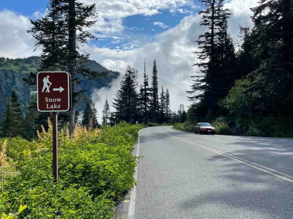
A short 2.7 miles, past Reflection Lakes and Louise Lake, there is a sign for “Snow Lake” and a small parking area to the right. The trailhead is tucked in next to the road, just to the right of the car in this photo. Only 15 or 20 vehicles can fit in the parking area, which is essentially a wide paved shoulder. Be alert for vehicle traffic and hikers in these tight quarters.
Since there are no amenities here, I am sure to bring water and snacks with me. When hiking with small children, it is a good idea to stop to use the restrooms at Comet Falls before getting to the Bench and Snow trailhead.
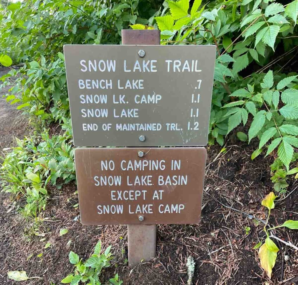
The small distance marker makes this look like an easy hike, and the guidebooks suggest it is a “moderate” hike. However, the trail undulates over several ridges, so while the elevation gain is listed at about 370 feet, with all the climbing and dropping down, expect it to feel more like 700 feet.
If you like to hike with poles, be sure to bring them. I’ve done this out and back hike in a little over an hour, but this trail is worth taking time to enjoy. I plan for at least two hours of hiking, and additional time to wade in the water, to have a nice nibble or lunch, and of course, to sit quietly and enjoy the views.
Starting for Bench Lake
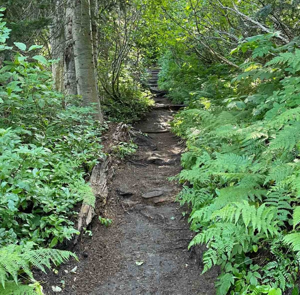
Unlike the rocky trails at Paradise, here the trail is sandy, and soft underfoot. That, combined with all the water that flows through this area during the spring melt, means that there are lots of counter-erosion measures. Expect plenty of steps up, and steps down as the trail rises and falls. The trail climbs quickly from the trailhead at a 7% grade.
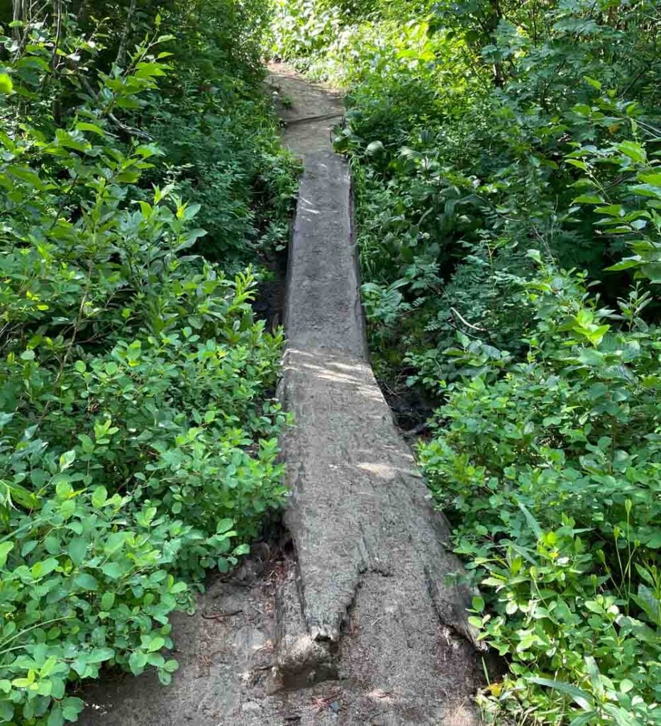
In early spring, fast moving creeks rise, but later in the season these retreat to shallow burbling brooks. To keep hiker’s feet dry, there are low bridges made from logs or arranged steppingstones. While it is tempting to only look around at the gorgeous scenery, it is a good idea to glance down to see what is underfoot occasionally.
When I hike this trail in July, I’m sure to check the National Park Service website for the current status. Heavy rain or fast snowmelt can wash out log bridges and move steam beds. If the trail has been closed, it will be posted online and at the trailhead.
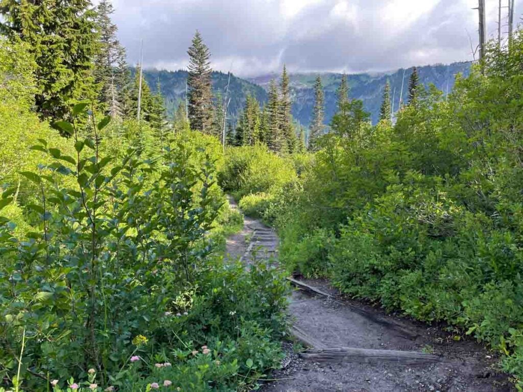
In this stretch of the trail, just after the Bench side-trail, plants grow to their brushy, bushy highest in the summer sun and warmth. It is always a good idea to stop and listen for other trail users when the foliage makes it hard to see very far ahead. Wildlife uses this cover to move about during the day, and I often see a fox or deer, or even elk slip by if I am paying attention.
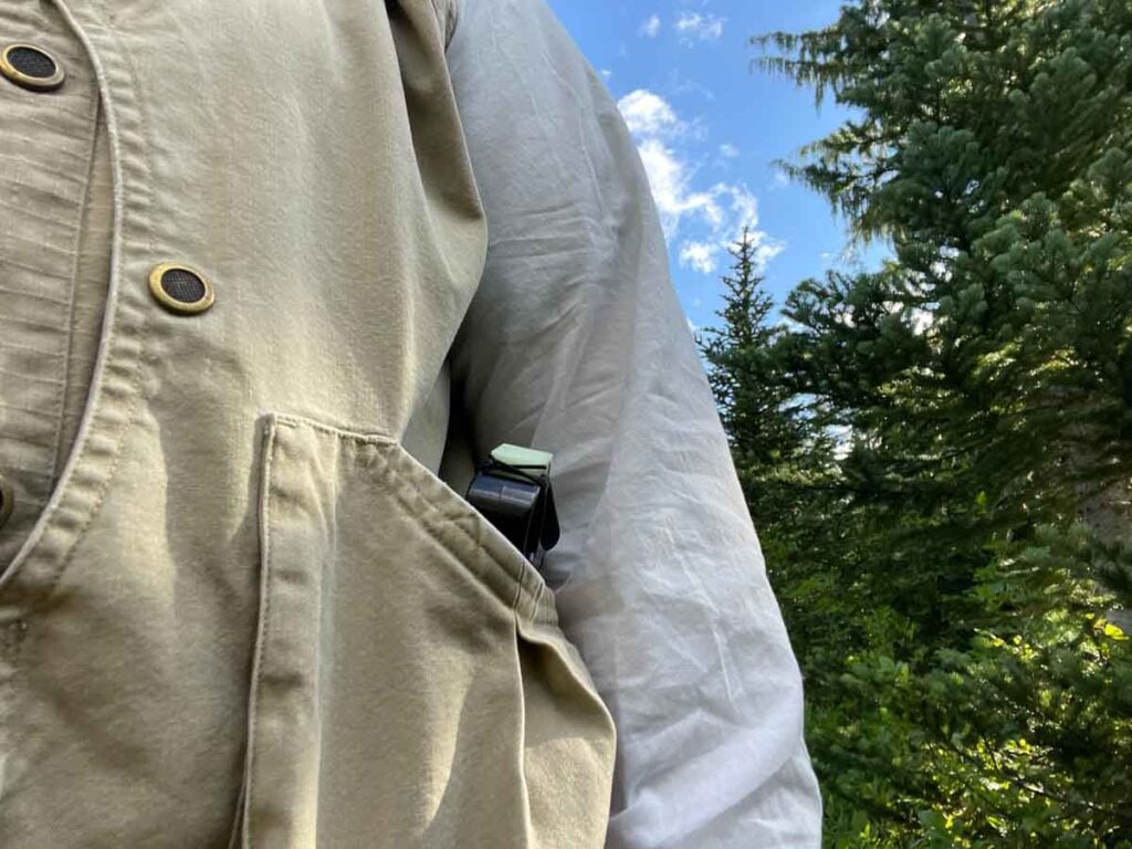
This is a wilderness area, so carrying bear spray is prudent. In twenty years of hiking on Mt. Rainier, I have never had a reason to use it. I have seen quite a few black bears, and by being bear aware (make noise when hiking, pay attention to surroundings, hike with a group on remote trails) the experiences have been amazing. It is incredible to see them at a distance, safely in awe of their speed, strength, and playfulness.
Nevertheless, hiking in wilderness designated areas means being careful and prepared. I carry my bear spray on my left side, as I am left-handed, and in an open pocket of my hiking vest.
At the end of each season, I replace my bear spray. I can then practice pulling, aiming, and spraying with the unused bear spray I carried all summer. If the configuration of the new can is different, then I buy two cans so I can practice with one before I carry the other in the coming season.
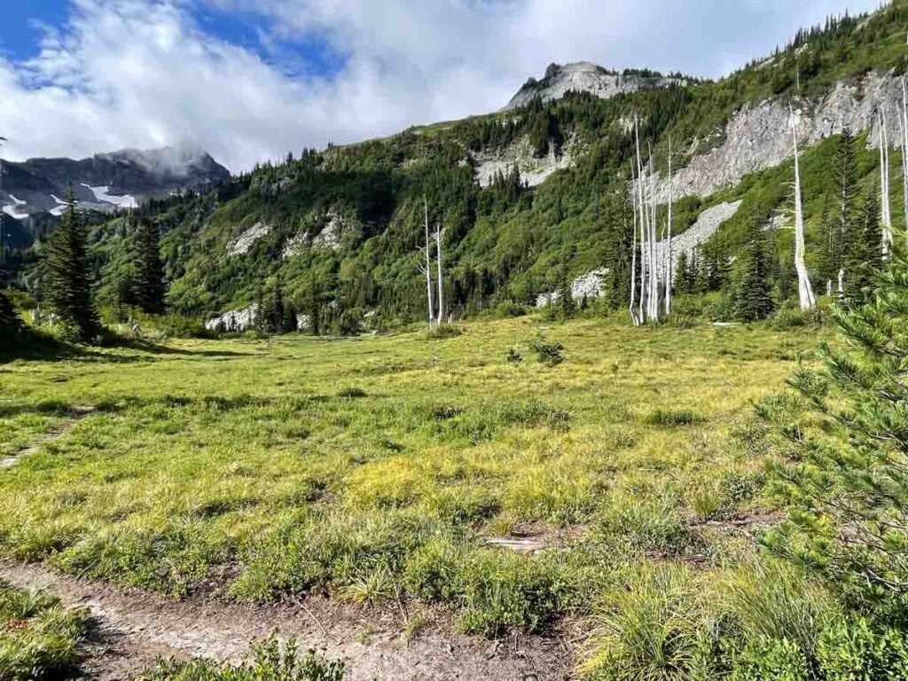
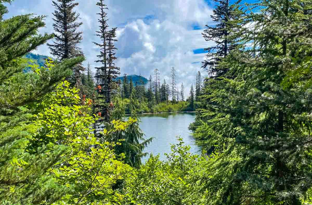
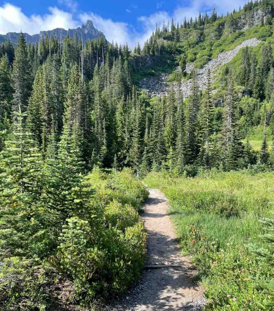
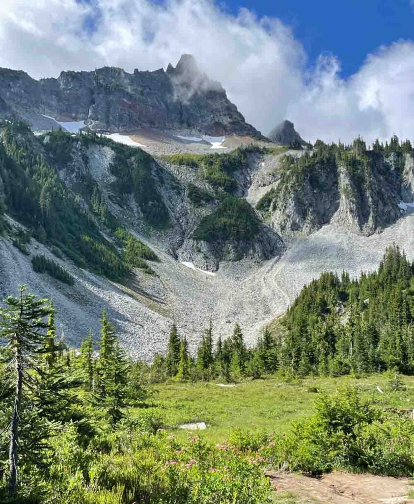
Moving on, as quickly as the thicket area appeared, it falls away to reveal an open meadow, ridges of rock off to the right, and if the clouds part, a first good look at Unicorn Peak. Even in late July there are snow fields above the cirque, feeding cold water into Bench and Snow Lakes. The cirque, shaped like a giant amphitheater with the mountain at one end was formed over time by glacial erosion.
Bench Lake

The entire Snow Lake Basin holds lots of water from winter snow and higher elevation snow melt, so there are small ponds throughout the valley. These shrink through the summer months and then become filled again after the winter snows begin to melt.
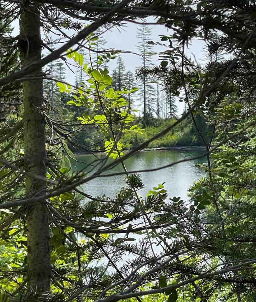
Bench Lake’s name reflects the typography here. The lake rests on a “bench” between the ridges that surround it. That also means to get all the way to the lake I need to take a short but very steep side trail. The plus side is that often there are fewer people at Bench since the trail down is rough on injured knees and short legs. Small children definitely need a bit of help getting down and back up this side trail.
On a hot day, the water is refreshing, and swimming is allowed. However, this water can be exceptionally cold, even late in July because both Bench and Snow lakes are fed by snowmelt. That means freshly melted snow is filling the lakes as late as August. I’ve cooled my feet, but it was way too cold for me to jump in. I’ve seen people fishing, but they don’t go out into the lake without waders on to guard against the cold water.
On to Snow Lake
After the turn off for Bench Lake, the trail drops again into another open meadow with trees at its edges. The trail’s soft powdery sand throws little puffs into the air with each footfall.
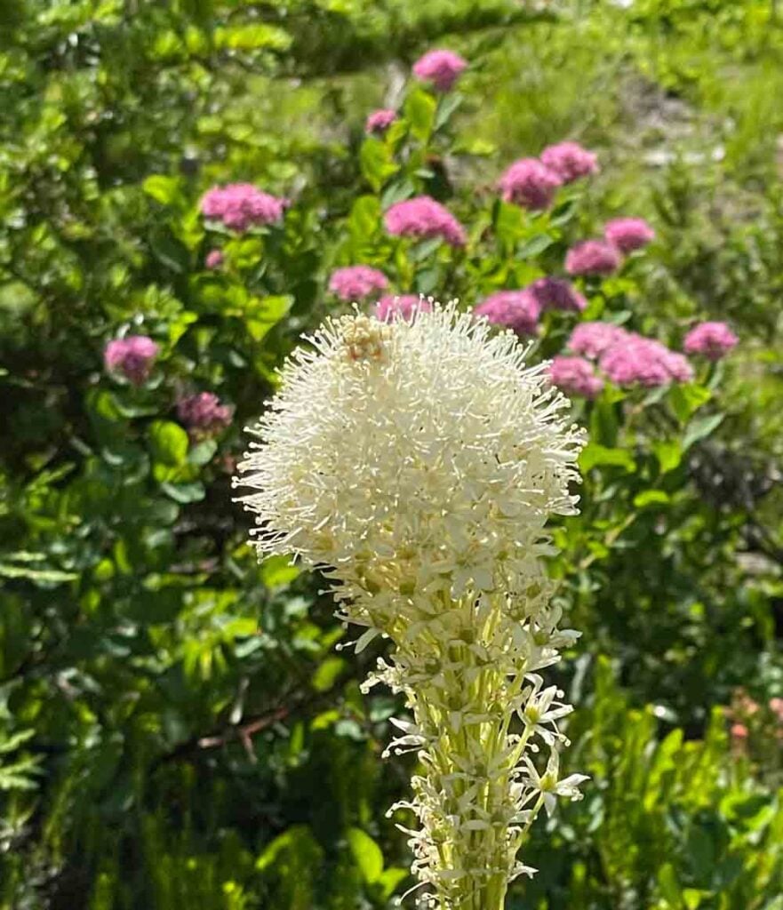
In the open meadows, flowers like Paintbrush, Queen Anne’s Lace, and my favorite, Bear Grass bloom with intensity through the short summer season. The snow melts enough for plants to grow by late July and will return in September. Along with the flowers there are insects, birds, squirrels, and marmots scurrying about to eat while the pantry is full.
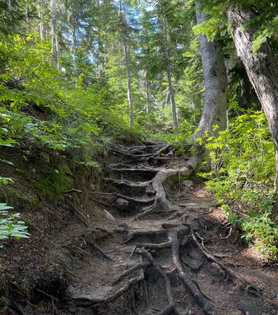
Finally, there is only one more small ridge to clamber over before Snow Lake. Water driven erosion leaves its mark on the trail, where the roots of trees become exposed steps.
Snow Lake and the End of the Trail
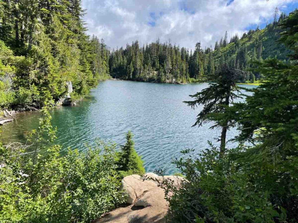
Snow Lake is bigger than Bench Lake, and the water is deeper. There are open rocky spots along the edge of the cold, crystal clear water. The outcropping here is where I like to rest, eat the food I brought with me, and enjoy the peace. If the sun has broken through, as it did on this day, I take off my hiking boots to wade in the water. There’s no need for a towel, as there is sunshine and time for my feet to dry before hiking on.
This is the end of the trail, where the walls of the cirque rise quickly at the back side of Snow Lake. It is a beautiful spot, with few visitors late in the day. For those who want to stay over, there is limited rough camping available at Snow Lake. A permit is required from the National Park Service, and, of course, no fires are allowed.
I like to walk out to the end of the trail, where a small brown sign is driven into the ground just before the forest and the rock wall leading up to Unicorn Peak close in. After tapping the sign, I smile, turn around and head back toward the trailhead, just over a mile away.