On the many trails around Mt. St. Helens, an August hike is reliably warmer. Summer winds are steady, changing the way the mountain looks.
The light ash in the blast zone is easily picked up and suspended in the air, creating a less green appearance.
Then along with the lack of rain, which will have stopped almost completely by the beginning of July, vegetation turning brown completes the transformation.
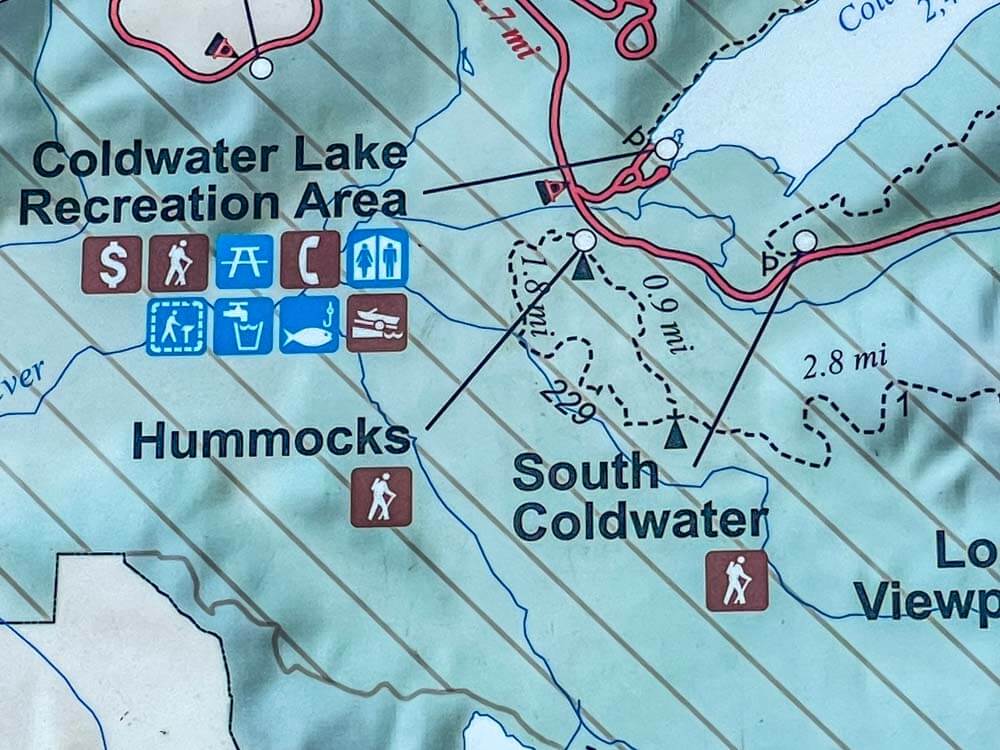
During summer, I like to hike sections of the Boundary Trail #1, so my plan was to start at the Hummocks trail, walking about a mile to the junction with Boundary Trail #1, and then climb up the rest of the 4 and ½ miles to Johnson Ridge.
I plan for 10 miles when I am doing an out and back. However, on this day, my plans would change and I would divert to the smaller 2 mile Hummocks Trail Loop.
Getting There
To get to the trail head from Interstate 5, I turn east on to 504, Spirit Lake Highway, at Castlerock, WA.
After the 1980 blast, portions of this road were re-constructed above the original valley floor.
At the 43-mile mark, I take the turn to the Johnson Ridge Visitor Center.
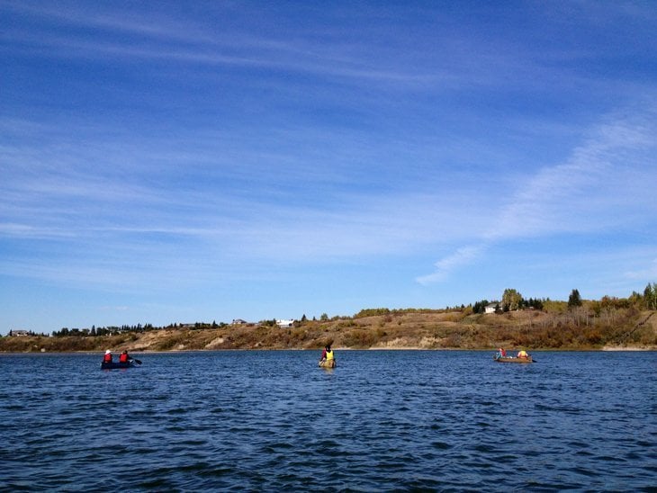
Still on Hwy 504, I’ll pass the entrance for the Coldwater Lake ramp and trailhead.
At about two miles from the turn to Johnson Ridge, the Hummock’s Loop trailhead and parking lot are on the right.
Starting Out
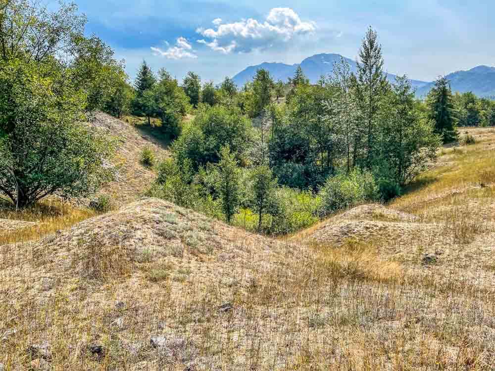
The Hummocks Trail provides an easy to access walk amongst the hummocks created after the eruption of Mt. St. Helens 40 plus years ago.
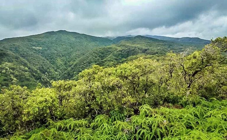
With a speed that astounded scientists, the area has rebounded from an apparently lifeless field of ashen heaps to a variety of small ecosystems that support small forests, marshes, and savannah, with the expected wildlife inhabiting the area.
The loop trail is filled with gentle undulations over and around a section of the hummocks that is within range for a hike that is close to the parking area, short enough for smaller children to enjoy, and still filled with surprises around every bend.
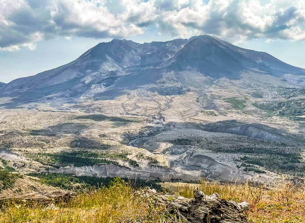
And of course, on clear days, the crater in Mt. St. Helens hovers nearby.
Hummocks
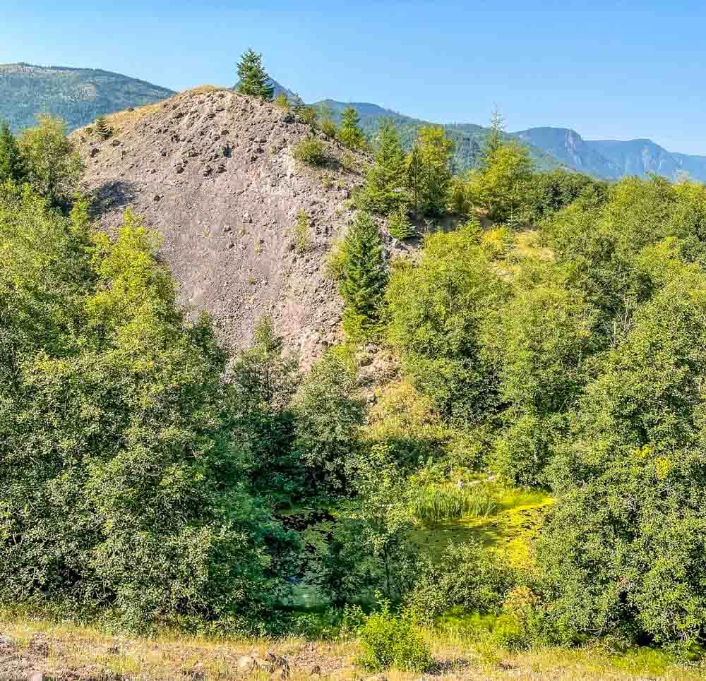
So just what are hummocks? Generally, hummocks are defined as small knolls or mounds of varying heights, but generally under 50 feet, they are found in groups.
These hummocks were formed after the mountain blew, and are formed from the portion of the mountain that fell away during the eruption, as well as the materials that were scooped up by the pyroclastic flow that scoured the opposing ridge and flowed down the North Fork of the Toutle River.
Rain, heat, and time have softened their appearance so that on a quiet summer day it is easy to forget their origins.
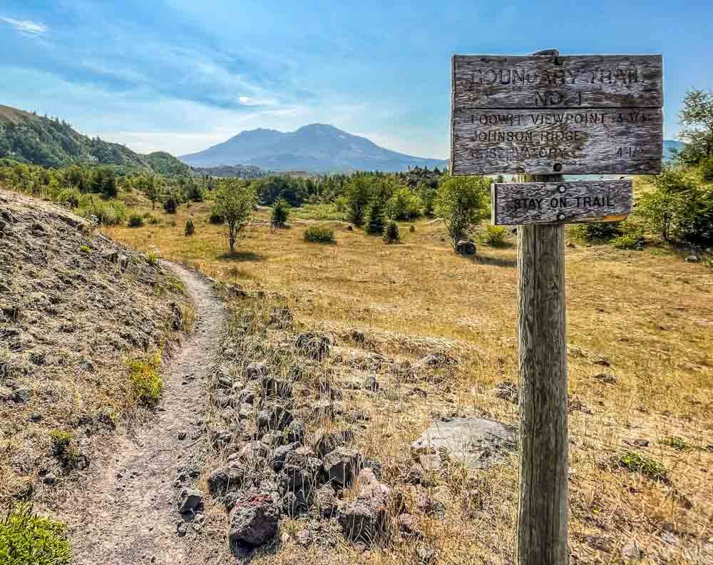
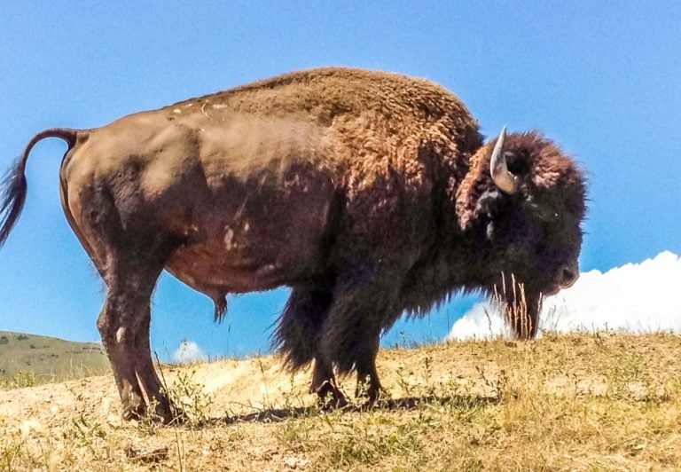
Plan A for the day was to hike the 4 ½ miles up to the Johnson Ridge Observatory. This time of year, this trail is less popular, and I was hoping to see more wildlife, including a variety of birds, small mammals, a coyote, and some of the elk that roam this section of the park.
I started toward Johnson Ridge, and about ½ mile down the trail, ran into some not so old bear scat. This was not concerning, other than to notice.
Black bears move through the area, sometimes using portions of the trail system, so I was not surprised. I was, however, a little concerned that this bear’s leavings were relatively recent, perhaps 24 hours ago.
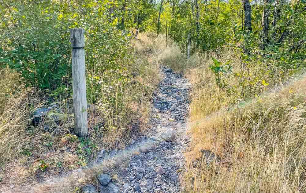
After about another mile, the trail starts to climb and moves though brushy areas, and then I found the second black bear scat right in the middle of the trail– much fresher than the first. I turned around on a dime and headed back for the loop.
Why turn around? I was hiking alone on a day when I was counting on a peaceful section of trail, which also meant not many other people would pass by. I had my usual pack with 10 essentials, a poncho liner in case I tripped up and had to spend a night out, and of course my bear spray in my hiking pants pocket, right under where my hands rest while I’m walking. I’ve been carrying bear spray for years, and I’ve never had to use it. I’d like to keep it that way.
It was extremely unlikely that I would startle a bear, but better no chance at all. I can always come back another day.
I turned back and decided to walk the loop trail instead. As always, when I plan a solo hike, I had let a friend know what my plans were for the day, and included this second option in case I needed to make a change.
When hiking in national parks and the back country, it is extremely important to let someone else know your plans. If I have a misstep and twist an ankle, or run into a grumpy bear, having someone to alert a search party who can let them know where I was going is not only polite, but can bring help much more quickly.
Of course, I always contact my friends as I enter and exit trailheads, or at the point of the closest cell phone service.
Ponds
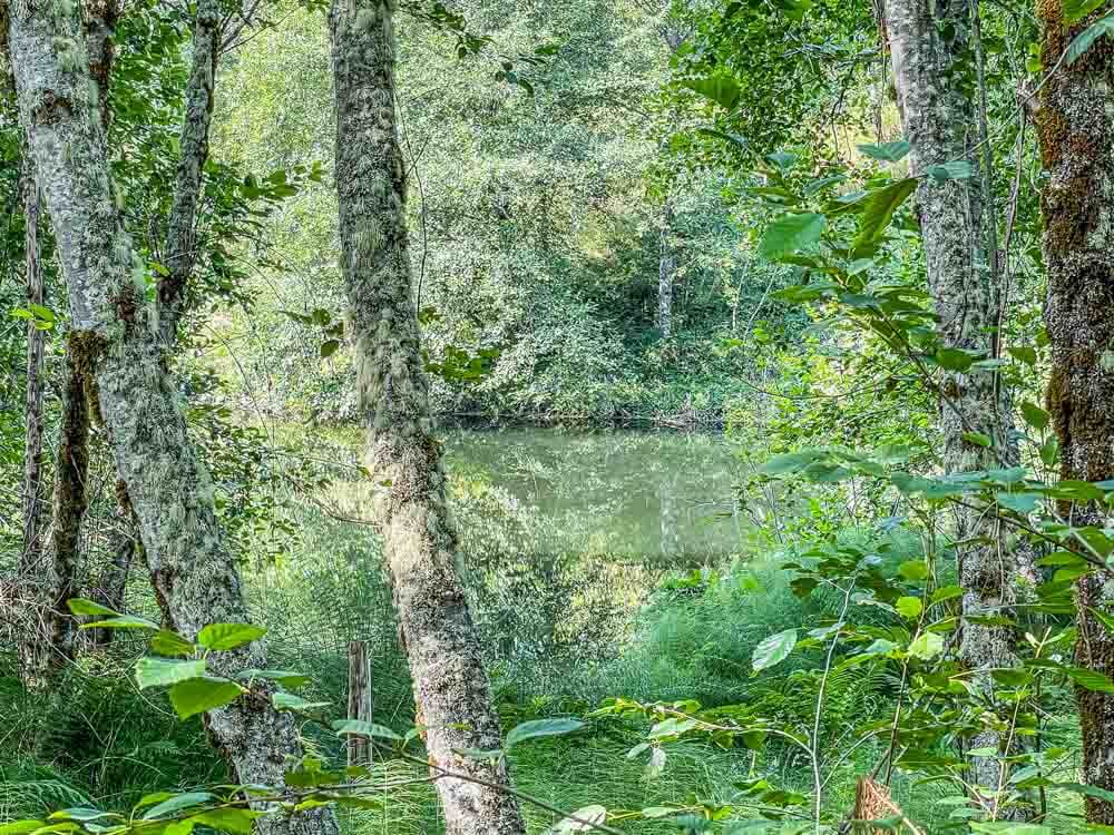
Back on the Hummock’s Trail, I encountered the first of a series of ponds. Beaver have returned to the area, and their work, along with the deep dips created by the base of the hummocks make a perfect space for little ponds.
The vegetation and ponds developed over the last forty years, so every time I hike here, I notice the changes in plant growth and variety that happen in just one year.
Water birds, insects, and amphibians are easily spotted in these ponds, especially in the early morning and late in the day. These ponds and the trees that spring up around them also provide a dramatically cooler section of trail. Sometimes I like to linger here, listening and enjoying the shade.
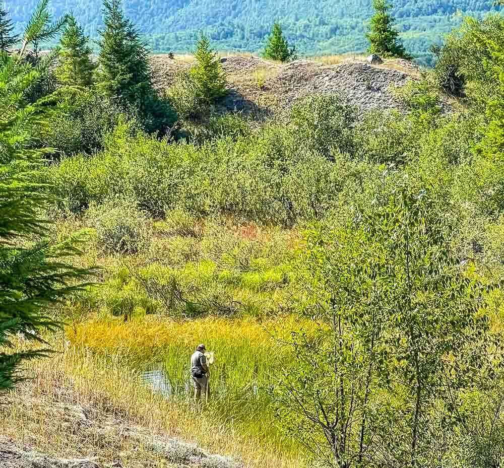
If hiking anywhere near Mt. St. Helens, I expect to encounter active research.
Out on the pumice plain in front of the crater there are marked spaces where scientists have been monitoring the return of various plants. Here, in the midst of the hummocks, this researcher was using a skim to monitor changes to the flora and fauna living in one of the marshy ponds.
Eruption Reminders
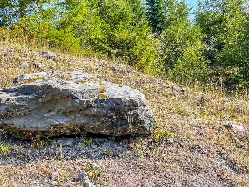
Walking along, there are distinctive chunks of mountain scattered about. While most people are not surprised by the boulder field that must be scaled when climbing Mt. St. Helens from the south, the large rocks and boulders that rest along the hummocks trail are less expected.
The crater is about ten miles away, as the crow flies, so visitors may not realize the strength and extent of the blast zone until they encounter these “mountain guts,” as one national park guide colorfully described them. They rest on the ash and rubble that were carried down by the eruption and its aftermath.
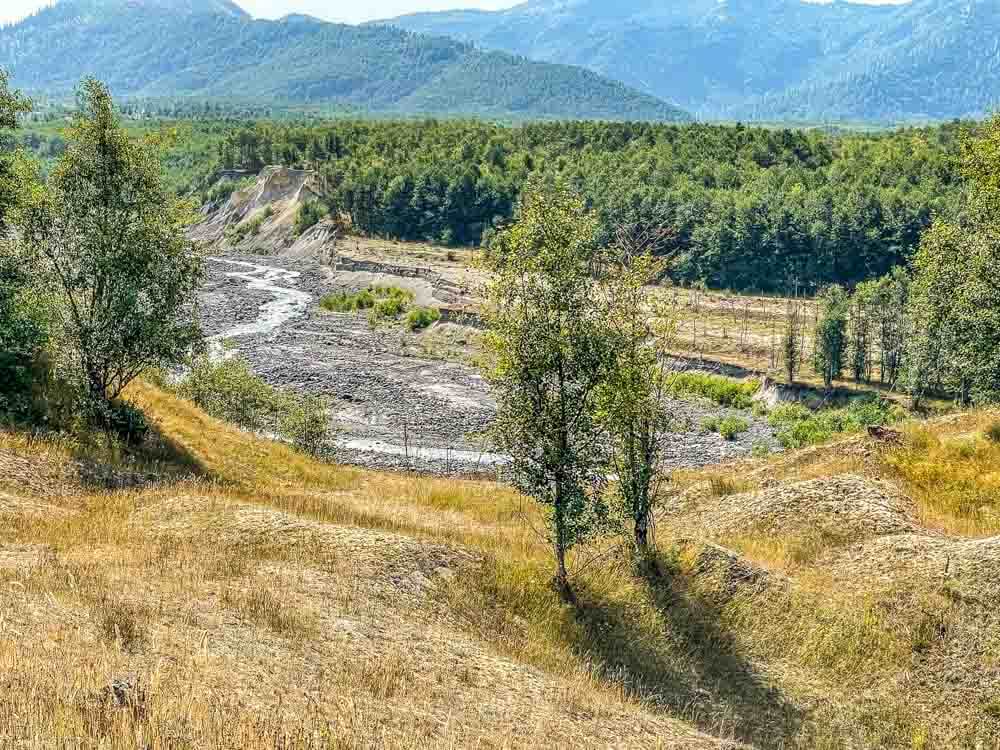
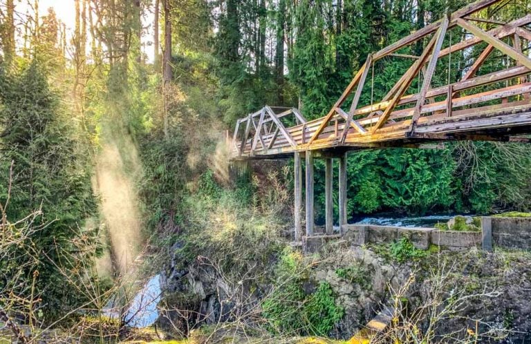
The North Fork of the Toutle River marks the boundary of the Hummocks Trail.
The original river bed is about 150 feet below. What is visible today is the top layer, sometimes called the “cap” of the tons of mountain that were blown out during the eruption.
Debris continues to move downstream, creating an ongoing challenge for managing water and rock that is moving toward communities and roads, including Interstate 5, the major artery for goods and people that runs north to Seattle and South to Portland.
This is also a great spot to pull out the binoculars and watch for the elk herds that linger along the river.
The hummocks continue to wear in response to weather and the occasional shake of the ground, as the area is seismically active.
Along the trail there is evidence of this change with layers of hummocks revealed as they slough off. I am constantly fascinated by the interplay of these rock and ash heaps with the plants and animals that repopulate the area.
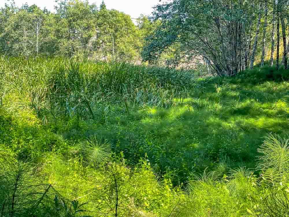
The last section of the loop has a wide, well-established marsh with cattails and tall marsh grass. Once again, the sights and sounds of a unique ecosystem appear along the trailside. The trees nearby are larger and more established.
Natural Forest Returns
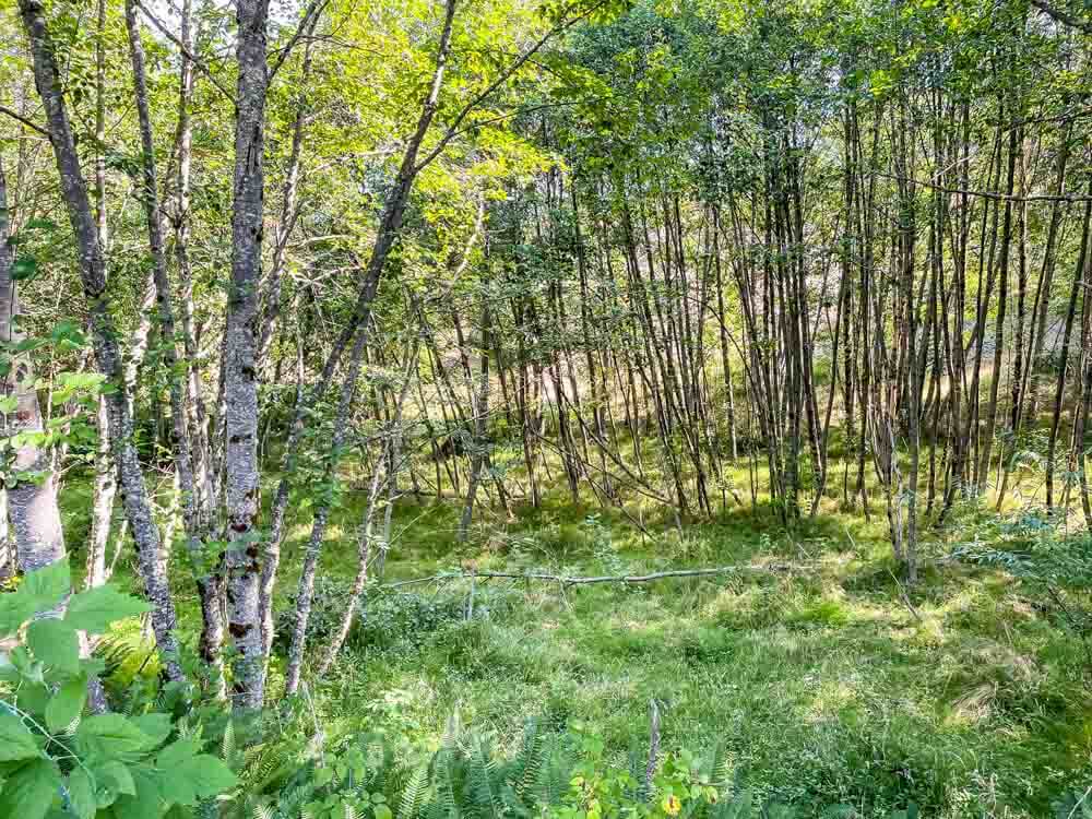
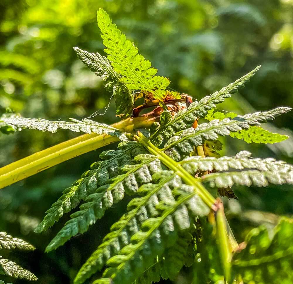
The trail twists back into the alder forests, and ferns are abundant. A constant water supply and cover from the returning forest encourage their spread.
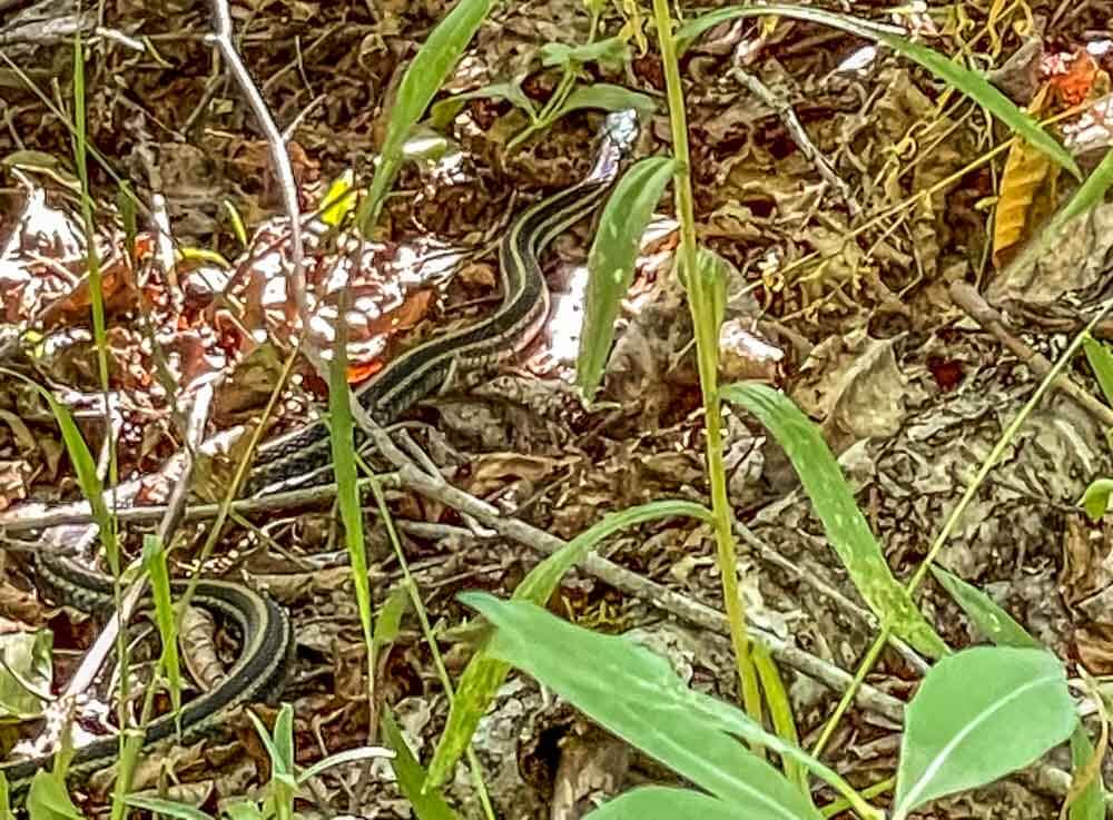
Garter snakes blend in so well with the leaf litter and dappled sunlight it is easy to miss them. They are not aggressive or poisonous.
There are no native poisonous snakes on the West side of the Cascade Mountain Range, so a rustle from their movements invites me to watch for them.
Finishing Up
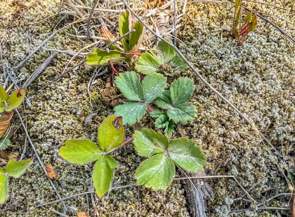
Where ever there is a break in the canopy, there are wild strawberry plants. They grow tiny little tart red fruit that all the local critters are happy to eat, including me.
If it was a little earlier in the season, I could have snacked on tart, juicy strawberries, but by August they are all gone.
As I finished the loop back to the parking area, I did have snacks in my pockets, so I nibbled on a bit of chocolate while I walked the last stretch to the car. I’ll plan another hike up to Johnson’s Ridge with a couple of friends another time, but for now, the little loop trail didn’t disappoint.
Besides, I had time to stop off at Betty’s Place, a roadside restaurant in Toledo, WA, for a chocolate shake on the way home.